June 16, 2022: Good morning, Roatan! Mid- and west- island locations got from half to three quarters of an inch of rain yesterday morning, while we on Jonesville Point only got .04 of an inch.
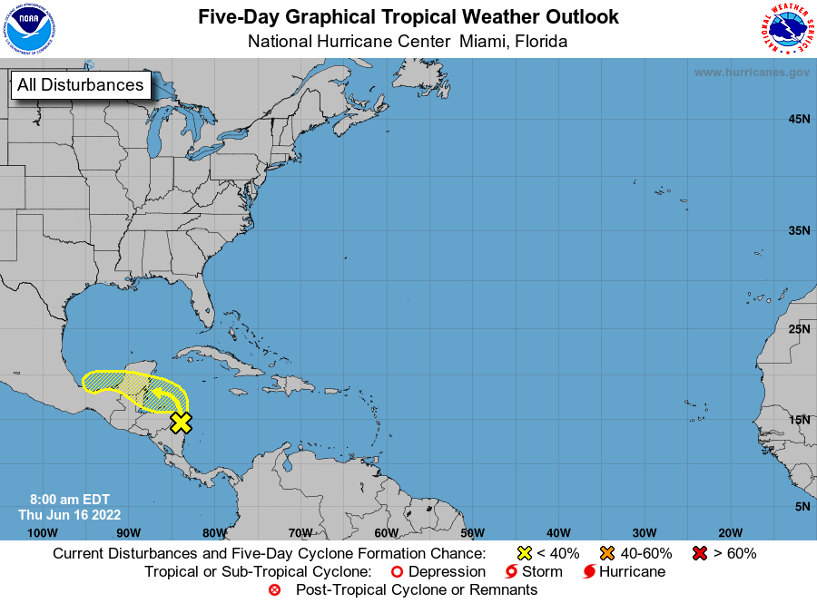
All eyes are on the storm that now has only a 20 percent chance of becoming a tropical system. It looks more and more like it will just be an unorganized group of storms, especially as it passes over us the next 36 hours.
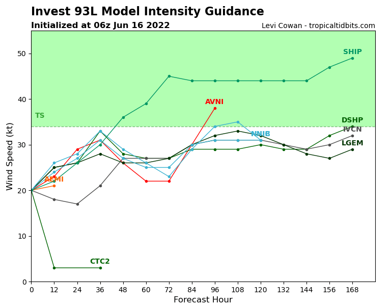
In the intensity models, you will notice that all models (except for one that has the system completely dying) have the storm at only 20-30 mph peak winds as it passes over us tomorrow. That is more of a squall than a storm.
Winds and seas should be fairly calm over the next couple of days and there will be a good chance of showers, especially starting tonight and running through tomorrow.
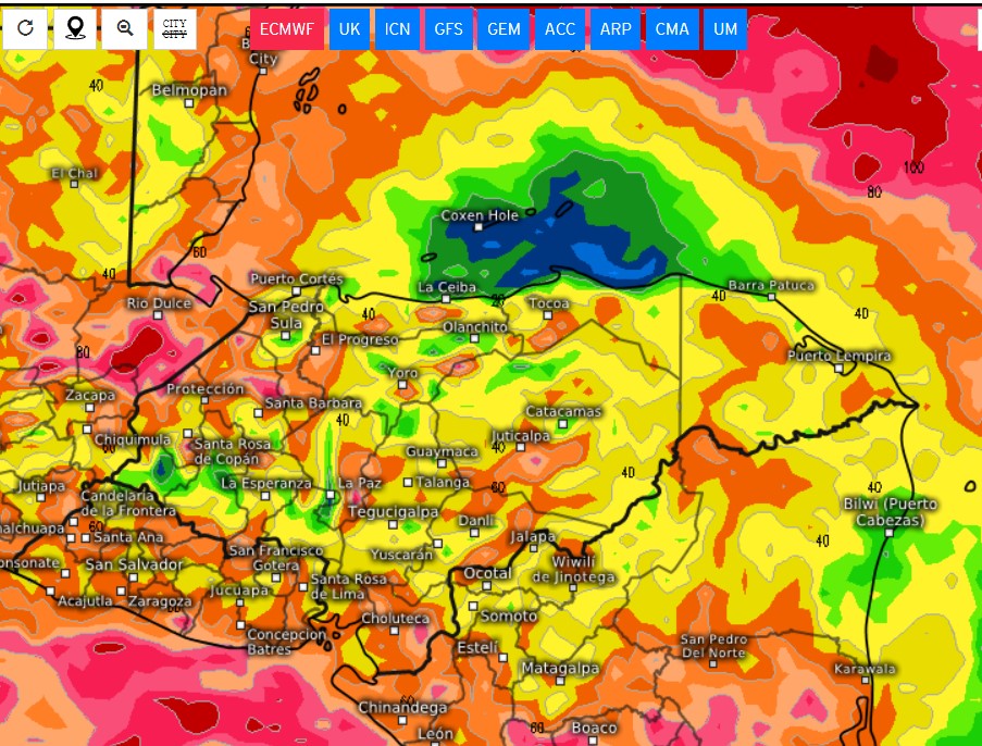
The European model (and many others) put our rain total at under an inch.
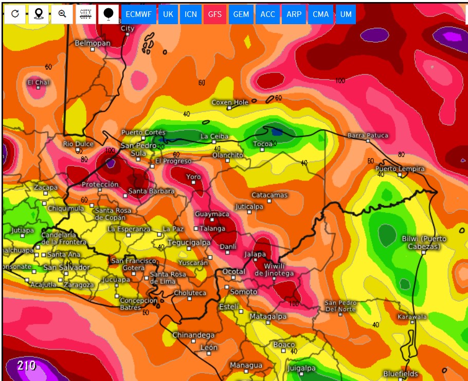
The US GFS model says about 2 inches for most of us through the weekend (the maps shown here are rain totals through midnight Sunday night/Monday morning). There will also be a chance of a rumble of thunder.
Saturday should be a very calm day and nice, if a little cloudy.
Trade winds start back up on Monday and Monday night could be quite windy. Have a great Friday!
