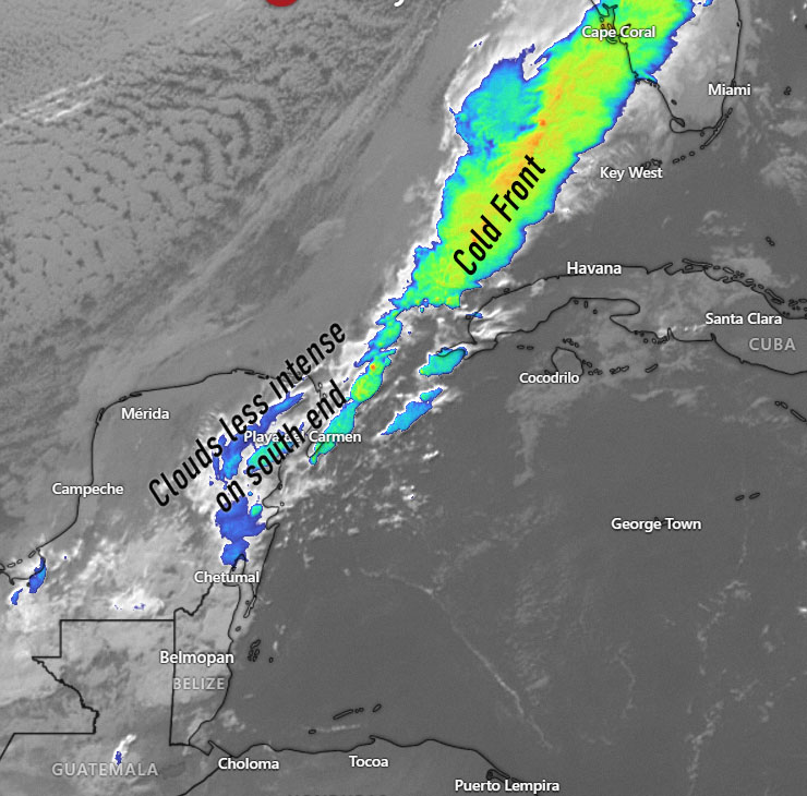
Jan. 16, 2022: We’ve had a gorgeous 24 hours ending this morning. Today we will see a cold front come through, but as you can see in the satellite, the clouds are not as heavy on the front’s south end. That could definitely mean less rain for us than we normally see in a cold front. Clouds should increase through the day and winds will be 15-22 mph, first from the west, then from the northwest, meaning seas will build on the north side.
Tonight and tomorrow morning we should have strong north winds in the 20 mph range, giving us seas around 4 feet (1.3 meters) on the north side. Tomorrow should be mostly cloudy and cool with a chance of light rain showers. Tuesday morning will start off cloudy and quite cool. This is the morning I have my eyes open for some readings in the upper 60s (19 or 20 C). Winds will be much calmer, from the east, northeast at 10 mph. Seas will be in the 1 to 2 foot range (.3 to .6 meters) both Tuesday and Wednesday.
Rain chances increase Thursday into the weekend.

I really appreciate these consistent weather reports! Would you consider adding the current water temperature?
I don’t know anything about this, so don’t know how difficult a request that may be.
LikeLike