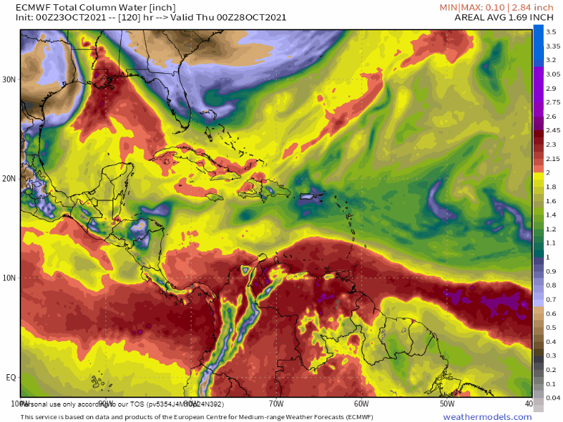
Oct. 23, 2021: The big news this morning is that we have a chance at our first “norther” of the season next weekend. The video shown here is the water vapor prediction in the European model. It shows the drier air, shown in green and blue, pushing the wetter air (yellow and red) out of the way about Oct. 31. The U.S. model thinks the front will stall just to our north and bring us good chances of rain, but none of the cool, dry air that comes when a front passes through. It is hard to say this far out, but in my experience, the more aggressive models (front will pass through) tend to be wrong and the more conservative models (front will stall) tend to be correct.
Today we will have TRW (Typical Roatan Weather) with east winds 10-15 mph and seas 1-2 feet (.3 to .6 meters) and about a 30 percent chance of a shower, especially in the evening.
Tomorrow we’ll have winds 12-17 mph and seas 2-3 feet (.6 to 1 meter) and a 20 percent chance of a shower.
After that, rain chances get really, really small and the wind sticks with us. Have a great day and Go Braves!
