
Good morning Bay Islands. Our photo of the day comes from Michelle Peedee in West Bay.
This morning we have dealt with some morning showers. Showers should decrease as the morning goes on, but we will remain partly cloudy today. Tomorrow looks drier and we are waiting for some pretty strong north winds Saturday night into Sunday morning.
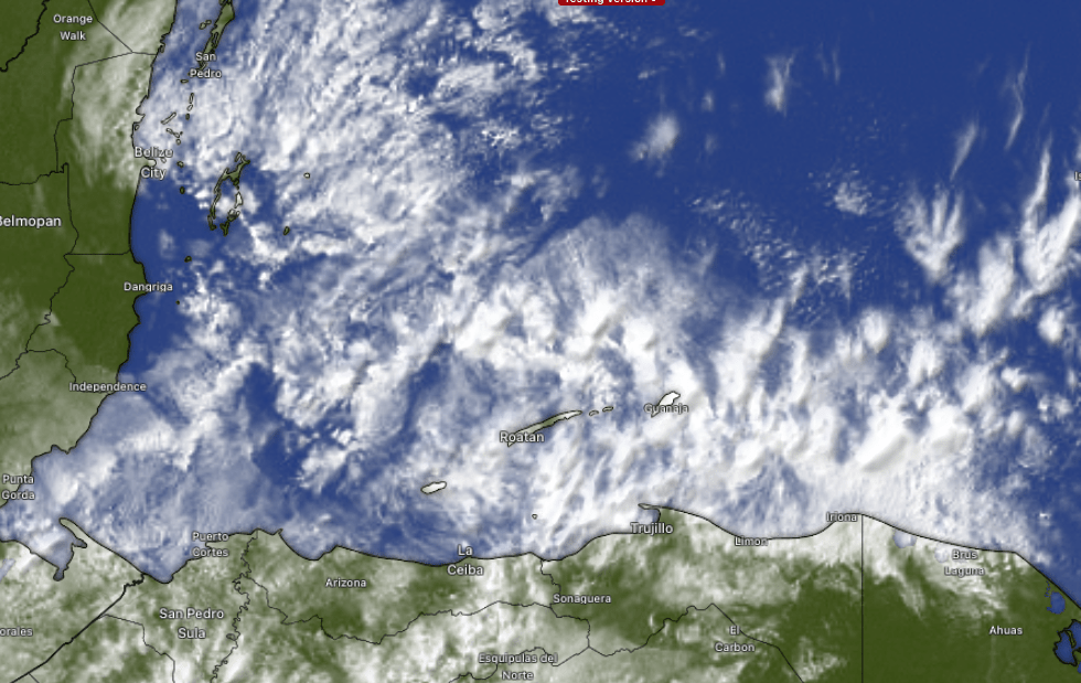
On satellite we can see our clouds at 8:30 a.m. We will have a shower here or there today and partly cloudy skies. We should be mostly sunny tomorrow. Chances of rain will increase tomorrow evening as the cold front approaches and through the day on Sunday we will have a chance of light, steady, cool rain at time, but our rain totals shouldn’t be too bad and I’m not concerned with flooding in this norther.
Wind and wave forecast: Today and tomorrow morning winds will be moderate, mostly from the north around 10 mph and seas around 3 feet. Starting tomorrow evening we will see the winds pick up to 12-17 mph out of the north and seas to 4, maybe 5 feet, but the real bad seas are overnight tomorrow into Sunday morning, with north winds 20, gusting to 30 mph and seas 7-8 feet. Winds will calm on Monday, but seas will still be wavy around 5 feet into early next week.

On this forecast map, the blues are temperatures 5 to 10 degrees below normal. Our normal low this time of year is around 72 (22C) and normal high around 80 (27C). This is the longest period of below normal temperatures I’ve seen on the island since coming here in 2019. We will consistently have lows in the upper 60s (20C) and I expect to get close to our all-time low of 64 (17.8C) Monday or Tuesday morning. The cool temperatures last all the way to Feb. 10 in this forecast.
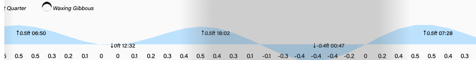
Tides continue to run quite low, especially around noon and 1 a.m. Have a great Friday!
