Good morning Bay Islands. Our photo of the day comes from Tony Lanoue in West End.
This morning as of 8 a.m. many of us have stayed dry since midnight after 1-2 inches yesterday. This has been a storm system that has been rainier the further west you go. Utila has half an inch as of 8 a.m. after 3 inches yesterday. Seas are quite high this morning.

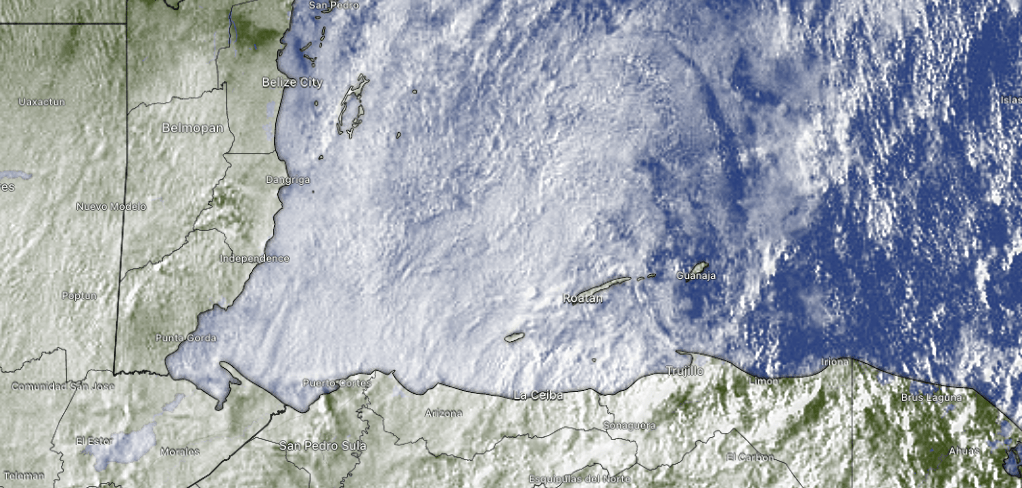
Here’s this morning’s satellite. You can readily see there’s even some clear sky just to the east of Guanaja at 8 a.m. We will continue to have scattered showers today, but some areas, especially to the east, should get less rain. The big story will be winds, with morning winds from the north 25 mph and seas 7-8 feet. Those conditions will last through today. Tomorrow morning winds 15-20 mph and 6 foot seas, should calm to 10-15 mph and 4 foot seas by evening. Friday and Saturday morning winds are from the north 5-10 mph and seas 2-3 feet in advance of the next norther Sunday into Monday. The next norther will be drier, with even cooler air than we are getting with this norther. I seriously expect some mid-60s (around 17-18C) for lows, especially Monday and Tuesday morning.

With all these north winds, it is important to remember Jolly Roger Roatancan find you some calm waters inside the reef on the south side and get you safely back to your boat on time. Check them out at Jollyrogerroatan.com.

Lowest tide will be much below normal at midnight. Have a great Wednesday!