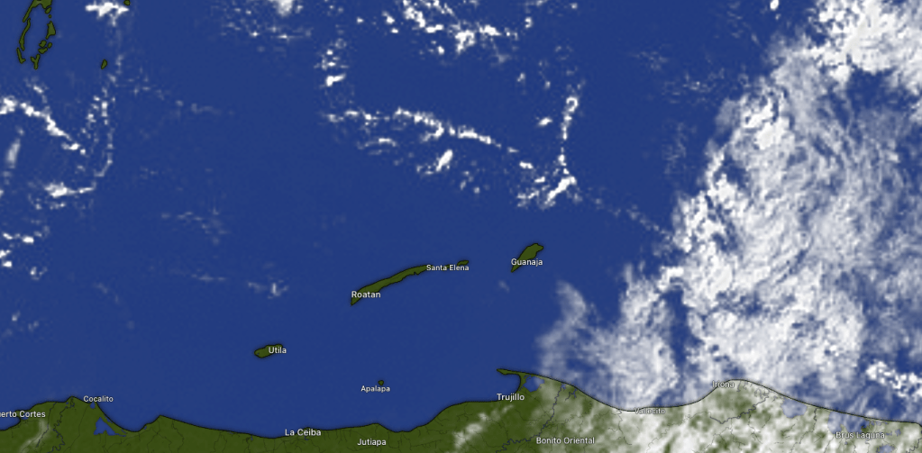
Good morning Bay Islands. We are clear this morning with some broken clouds to the east. We may get more clouds as the day goes on, but we should stay dry. I can’t say the same for the rest of the week.
Our forecast for tomorrow has gotten a little wetter. We have a small chance of a morning shower, but the rain chances should increase through the afternoon tomorrow. Tuesday looks like the rainiest day of the week, but scattered showers will persist Wednesday and Thursday with our mini-norther. On the bright side, Saturday into the following week looks quite dry.
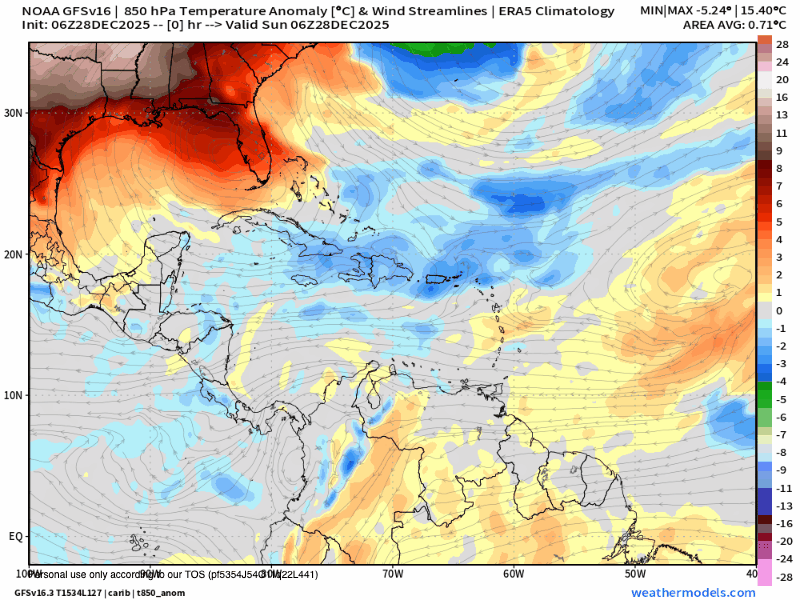
This is a mild norther, but we should get some fresher temperatures out of it. Here is the temperature anomaly forecast for the upper atmosphere. The blues are cooler temperatures. We are forecast for cooler conditions Wednesday through Friday, meaning we will mostly be in the 70s (low 20s C), with maybe a morning where a few of us get 68 or 69 (20C).

Lowest tide is 10 p.m. Have a great Sunday!
