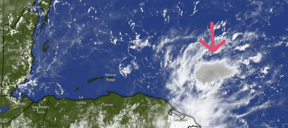
Good morning Bay Islands. No daily photo today as we look ahead to a stormy week. This morning we are mostly sunny, but we can see a storm brewing off the Mosquito Coast, what I like to call our rain factory. This should move west and will give us a good chance of rain this evening through tomorrow morning. This will also be the time this week that we have the best chance of a thunderstorm. Some of us may get missed, but if we get this storm tonight it could bring torrential rain and wind to some areas. And that’s just the start of our week.
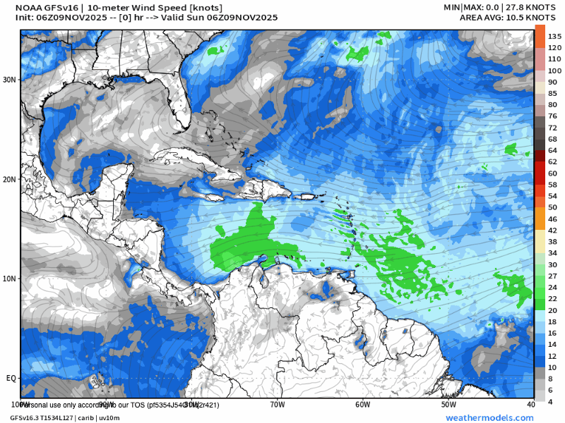
You can see a large and very deep cold front moving down from the States. This is an unusually cold mass for early November. It should hit us Monday night into Tuesday, and it will bring very high north winds and heavy seas, especially on Tuesday, but heavy seas should linger into Wednesday. At its peak we’re looking at 8-10 foot seas and 30 mph north winds, not a fun time on the beach or in a boat.
As we move into Thursday, if you look closely, you can see a low pressure system forming near us that should turn our winds around to the west and bring us 20-25 mph west winds and 6-7 foot seas Thursday. Fortunately for us, things start lifting out Friday and next weekend actually looks nice. We just have to get there.

All of the forecast rain models are pretty consistent in forecasting 8-9 inches of rain for us and 12-15 inches of rain for the coast, though there areas of much more (notice the area marked for 24 inches, or 2 feet, of rain to the west of Utila). None of these models will be exact, but we will all get A LOT of rain! Be very careful, watch for low level flooding and impassable roads, especially Tuesday through Thursday!

Tomorrow will be a good day to stock up on your meat supply so you don’t have to go out the rest of the week. Check out Carniceria Rosita and they will set you up.

On the bright side, tides look mild. Have a great Sunday!
