
Good morning Bay Islands. Our photo of the day comes from Monica Pleitez and shows the dead calm sea’s effect on a palapa at Las Palmas near the airport. We will continue to have dead calm today and tomorrow, but starting tomorrow night we will notice a slight increase in nighttime winds and by the weekend we will be back to daytime winds 10-15 mph and nighttime 15-20 mph with 2-3 foot seas. We will continue mostly dry, with only small chances of showers overnights and early mornings.
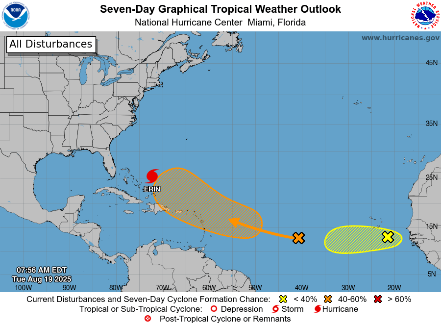
The latest NOAA NWS National Hurricane Center map shows a series of potential storms behind Category 3 Hurricane Erin. The one coming off the coast of Africa is forecast to go a little further south than the others, but right not it isn’t forecast to do much. One thing I will say is that a surge of cooler air at the end of August over the eastern US could have the effect of forcing systems more into the Caribbean, so keep your eyes open. We will too.
Low tide is 12:30 p.m. Have a great Tuesday!
