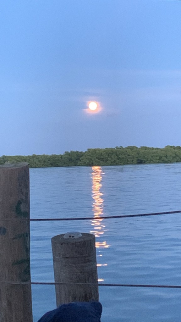
Good morning Bay Islands. Our photo of the day is this moon shot from Michael Fulford, taken from his boat docked at Trico in Jonesville Point/Czech Village. The rain missed most of us (except for Guanaja) yesterday. Will it miss us today?
This is our overnight satellite and you can see the counterclockwise rotation of a low pressure system moving to our north toward Belize. This morning we again have some storms to our east. These should at least bring some midmorning clouds and perhaps a shower here or there, but I wouldn’t hold my breath. Our forecast continues to have low chances of overnight or morning showers, about 20 percent each day.
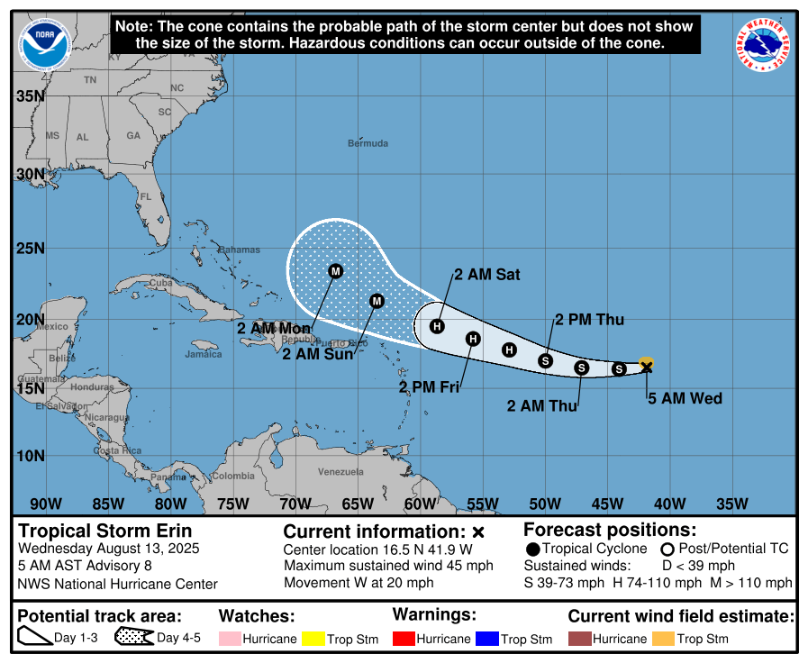
Tropical Storm Erin is forecast to become our first Atlantic hurricane of the season (MidAugust, can you believe it?). But it continues to move far from us, completely outside of the Caribbean. There is nothing in the extended forecast that makes us worried about the next two weeks around here.
Wind and Galaxy Wave forecast: We wake up to east winds 15 mph and seas 3 feet. They should calm during the day to 10 mph and 2 feet. We will continue with similar winds through Friday. This weekend into the first part of next week we are looking at close to dead calm conditions, perfect for being on the sea.
With great weekend weather in the forecast get ready with the best in steaks and pork chops at Carniceria Rosita in French Harbour and Coxen Hole!

Tides continue to be relatively high. Have a great Wednesday!
