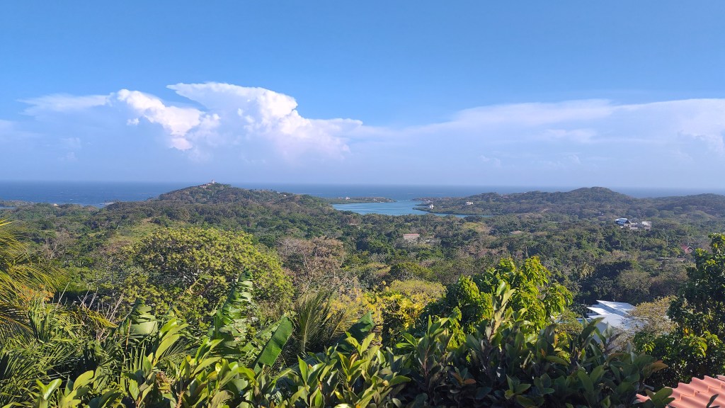
Here is a photo from Scott Anderson from First Bight near Kristi’s Overlook, looking back toward the southwest with mostly blue skies and a storm cloud in the background. The next couple of days should be like this, with partly cloudy skies and an occasional shower, until Monday night into Tuesday which looks rainier.
Here is the satellite between 1:30 and 7:30 a.m. We can see a couple of waves of popcorn clouds bringing us rain around 2 a.m. and 5 a.m. Most locations got small amounts around a tenth of an inch. We see more popcorn clouds toward Guanaja, so we will continue to have a chance of scattered showers through the morning. Today and tomorrow we will see a little rain, but also a lot of blue sky. Monday night into Tuesday we will have a surge of moisture, so we should have a few long-lasting rain periods, especially Monday night and Tuesday morning. Wednesday into the weekend we will have fewer showers and those will be mostly overnights and mornings.
Wind and Galaxy Wave forecast: We wake up to 15 mph east winds and 3 foot seas. Winds and seas will stay right around there today, getting up to 20 mph and 3-4 feet in toward nightfall. Tomorrow through Wednesday morning look quite calm, with east winds 5-10 mph and seas around 2 feet.

Don’t forget to get your tickets to enjoy the hidden treasure of the Bay Islands, Guanaja, during their Guanaja Conch Festival via Roatan FerryGalaxy Wave! Share your Conch Fest photo with me at bookmybio@gmail.com!
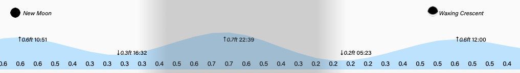
Tides are running fairly high, especially around midnight. Have a great Sunday!
