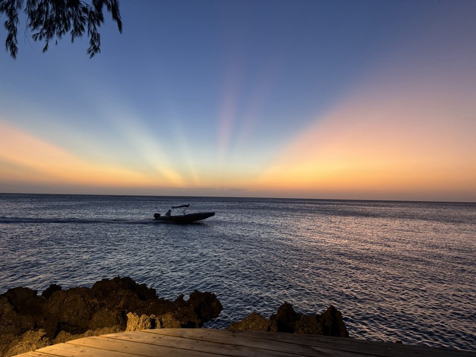
Good morning Bay Islands. Our photo of the day comes from Patti Yelinek near Las Rocas north of West End.
The five most-liked photos of June get an excursion from Jolly Roger Roatan valued at $100 complete with meal and drinks. Message photos here or at bookmybio@gmail.com with name and location.
We have one day of mostly dry weather before lots of clouds and perhaps lots of rain tomorrow and Thursday.
At 7:30 a.m. we have some clouds and showers moving in to Guanaja, which has already picked up .05 of an inch this morning. We’ll keep a chance of rain through the morning as these clouds move through. Many locations on the big island also got around .05 of an inch in showers that passed through 1 or 2 a.m.
Once these clouds clear out we should be partly cloudy today. A tropical wave is coming tomorrow and Thursday with lots of clouds and periods of heavy rain. After that we should have lower rain chances until another, smaller tropical wave around July 2.
Wind and Galaxy Wave forecast: We wake up to east winds 10-15 mph and seas 2 feet. As we get into Wednesday and Thursday the winds will be harder to predict. Generally when a storm system passes over our winds get a bit calmer in the rain, but approaching squalls and bring stiff and unpredictable winds so watch out out there. As we get into Friday and the weekend, stronger trade winds will return with east winds 20 mph and 3-4 foot seas daytimes and 25 mph and 4-5 foot seas nighttime.

Our buddy Mitch Cummins made it safely overland to Kansas City, but his employees stand ready to bring your pooch or kitty the healthiest, locally sourced food on the island. Contact him through Roatan Pets.
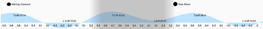
Lowest tide is 2 p.m. Have a great Tuesday!
