
Good morning Bay Islands. Our photo of the day comes from Thomas DeMille in West End.
We have some showers to our north at 7:15 a.m. and we will have a chance of showers today and tomorrow, but the there is a good chance of heavier rain Wednesday and especially Thursday.
On satellite at 7:40 a.m. we can see a line of thick clouds from Puerto Cortes stretching northeast. These clouds are to our north at the 7 o’clock hour and seem to be moving slowly to the southeast toward us. It is very possible that later this morning some of us will get some showers from these clouds. If you needed to find a day this week to do something outside and wanted to stay dry, tomorrow will be your best chance, as it should have the lowest chance of rain this week.
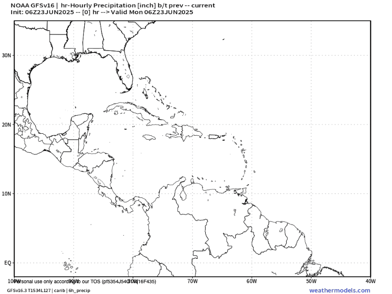
This is the GFS forecast through Monday. You can see a wave of tropical moisture moving in Wednesday afternoon and increasing through the day on Thursday before crossing over the mainland and possibly emerging in the Pacific as a tropical storm. Right now most models are giving us 2-4 inches from Wednesday afternoon through Friday morning.
On the bright side our winds are not as strong as they have been. We wake up to east winds 15 mph and seas 2 feet. Those winds and seas will be much the same today and tomorrow. Thursday, as often happens when a storm passes, looks a bit calmer at 7-12 mph and seas 1-2 feet, except if you get a squall you can get some locally heavy winds and seas. Trade winds look stronger this weekend again.

Explore Roatan real estate with the island’s top experts at Roatan Life Real Estate. Serving clients since 2001, we offer personalized guidance in buying and selling properties. Trust our dedicated team for unparalleled local knowledge. Start your journey at http://www.roatanlife.com.
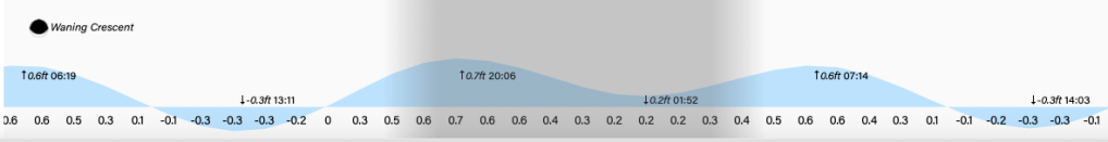
Lowest tide is 1 p.m. Have a great week!
