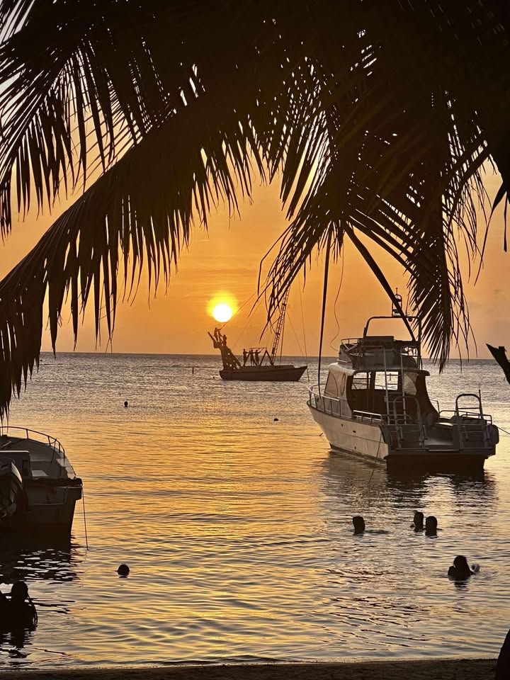
Good morning Bay Islands. Our photo of the day comes from Crystal O’Dell-Morrison and shows sundown at Sundowners in West End.
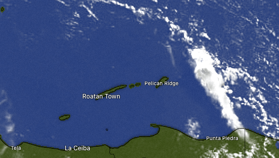
On satellite at 7:30 a.m. we see some clouds and probably some rain to the east of Guanaja. It is slowly moving west, so it is possible that Guanaja and maybe even east Roatan could pick up some rain later this morning, but these things tend to weaken as the morning goes along. The afternoon should be partly cloudy and warm and breezy.
Into the weekend we will have a small chance of a morning shower but mostly sunny the rest of the time. Sunday through Tuesday the chance of a morning shower increases, perhaps 30 to 40 percent chances each morning.
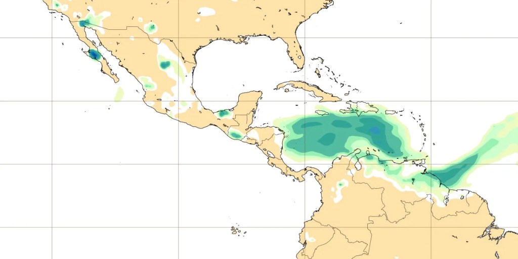
Here is the current location of the Saharan dust in the central and eastern Caribbean. It should pass over us tomorrow and Friday. Due to the strong winds aloft, it should completely pass us by weekend.
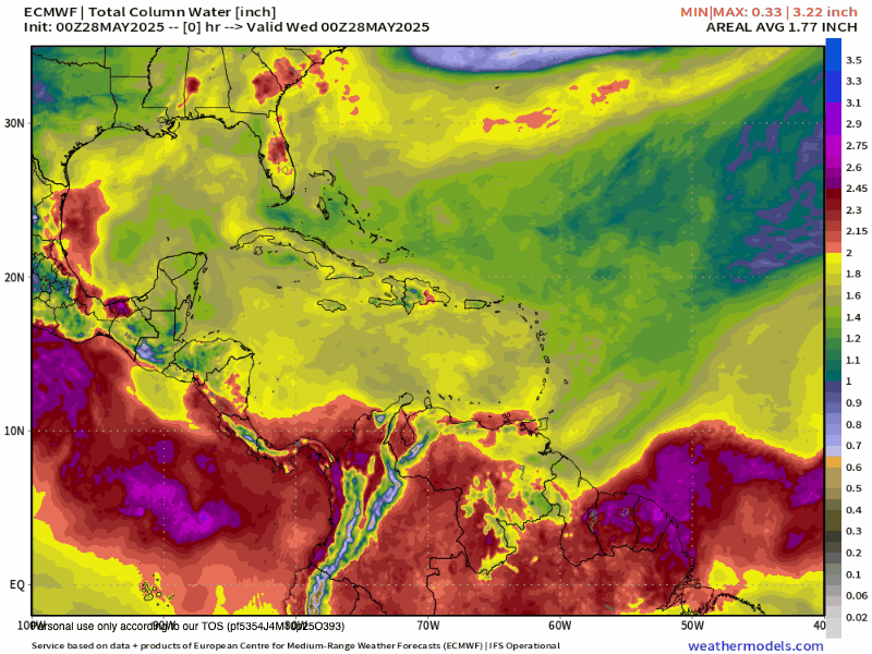
Here is the Euro model for moisture in the air. Yellows and greens are drier and reds and purples are wet to very wet. Starting June 3 and increasing until around June 8, we are looking for a lot of moisture in the atmosphere. This means squalls for us. There is still some modeling that is giving us a chance for some sort of tropical depression, especially toward June 8. I’m skeptical, but we’ll keep an eye on it.
Wind and Galaxy Wave forecast: We wake up to brisk 22 mph east winds and seas 4-5 feet. They should calm slightly midday before getting really breezy again this evening to 25 mph and seas 4-5 feet. Tomorrow will be similar to today. This weekend we get a little relief, with daytime winds around 15 mph and seas 2-3 feet and nighttime winds 20 mph and seas 4 feet.

Don’t forget the photo contest for May is sponsored by Jolly Roger Roatan. The winner gets a free excursion valued at $100 on a typical cruise day, including food and drink.
If you are interested in sponsoring the June contest, please contact me here.
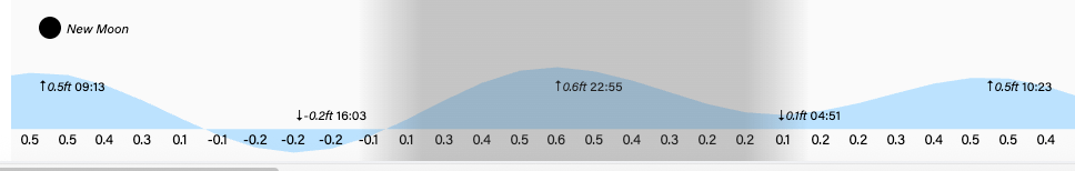
Lowest tide is 4 p.m. Have a great Wednesday!
