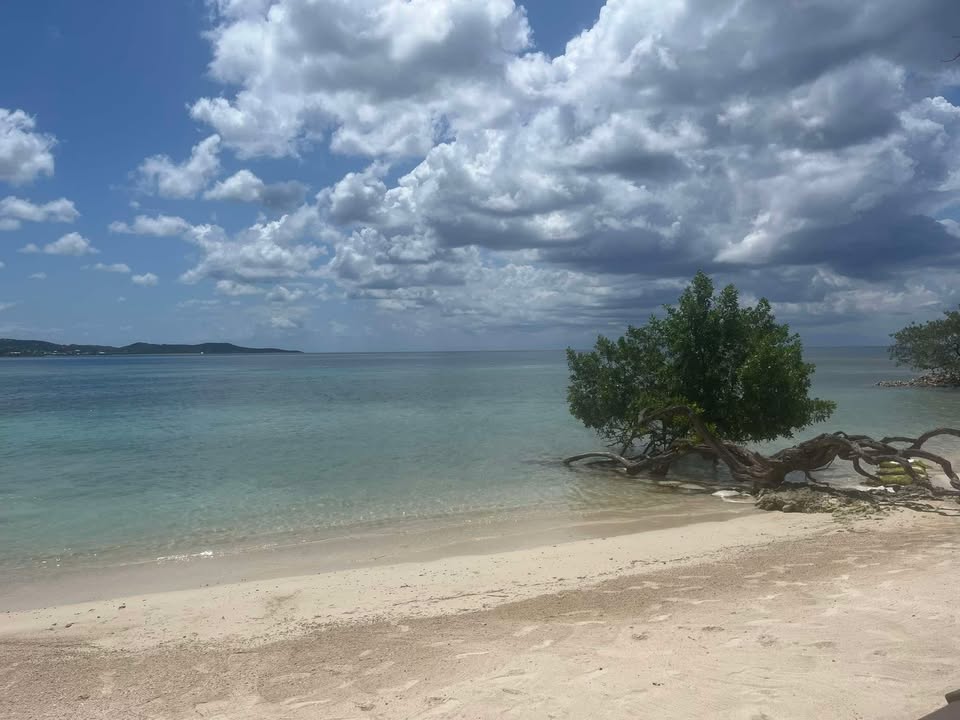
Good morning Bay Islands. Our photo of the day comes from Daniel Rice and show storm clouds gathering over Brady’s Cay in April. We will see storm clouds rolling in Sunday into Monday. Don’t forget you have a chance at an excursion valued at $100 complete with lunch and adult beverages (if you are an adult) from Jolly Roger Roatan. Send photos with location and photographer’s name to bookmybio@gmail.com.
Today and tomorrow we will have mostly sunny skies and dry conditions.
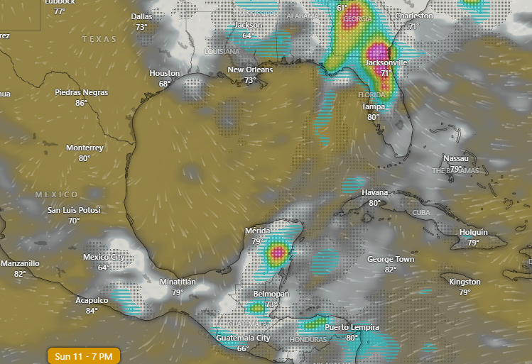
This is the GFS forecast for Sunday afternoon. You can see we have a very rare May weather front coming down from North America. We won’t get strong north winds like in a norther, but the wind directions will change, with Sunday evening into Monday winds coming from the northwest, though not very strong winds. This will bring clouds and rain Sunday through Tuesday morning. Chances of rain each day will be best overnights into the mornings, but we will also have scattered showers middays and afternoons.
Wednesday into next weekend looks dry.
Wind and Galaxy Wave forecast: We will have one more day with strong trade winds, 15 mph and 3 foot waves midday and tonight into tomorrow 20-25 mph and 4 foot waves.
Tomorrow midday we start to see things calm to 10 mph and 2-3 foot waves.
There is some disagreement in models about direction of winds, but it looks like Sunday we may see west/northwest winds 5-10 mph and seas 1-2 feet and Monday around 5 mph from the north and seas 1 foot.
Winds turn back to the east Tuesday and the rest of the week looks like typical trade winds.

Want to make Mom happy this weekend? Get a prime cut of meat and cook it FOR HER! But make sure you get the best meats at Carniceria Rosita.
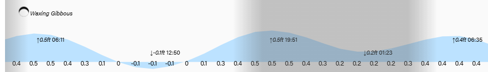
Lowest tide is 1 p.m. Have a great Friday!
