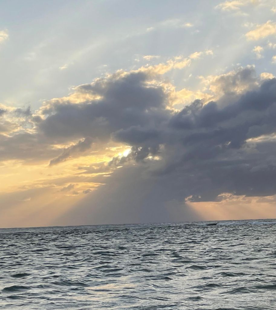
Good morning Bay Islands. Our photo of the day comes from Wendy Ousley and it is what she calls “a pyramid of rain on West Bay.” West Bay got about a quarter of an inch around 2 a.m., but the rain winner this morning has been the east side and Guanaja with over a half inch in Camp Bay and Guanaja.
We will have a shower here or there this morning, but we will get drier and sunnier this afternoon.
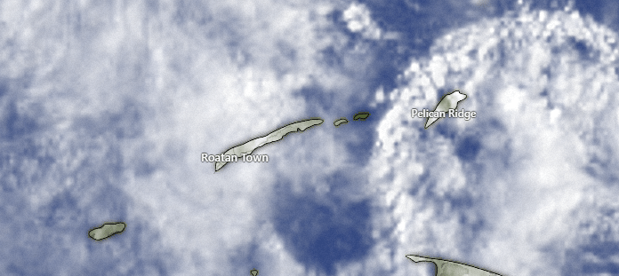
On satellite this morning we see a lot of clouds around at 8:30 a.m. and maybe a break in the clouds over the east side, with more clouds coming in over Guanaja. Theses clouds are moving to the west so we will keep a chance of a morning shower, but drier midday and afternoon. A chance of a shower comes back this evening and overnight, but we still look for a dry trend, especially Wednesday, Thursday and Friday morning, with a better chance of a shower Friday night into Saturday morning.
In the long range forecast we’re looking at the possibility of a weak norther toward the end of the 10-day forecast.
Wind and Galaxy Wave forecast: Winds continue steady at 15 mph from the east and 3 foot waves, especially southside. Tomorrow evening is when we will see those winds strengthen to 30 mph and 4-5 foot waves overnights and 20 mph and 3-4 foot waves daytimes. Winds will calm back down to 15-20 mph as we get into the weekend.

I know how stressful it can be going on a shore excursion on a cruise and worrying about getting back to the boat on time and whether you can trust your guide. Leave those cares behind with a guaranteed stress-free excursion from Jolly Roger Roatan.
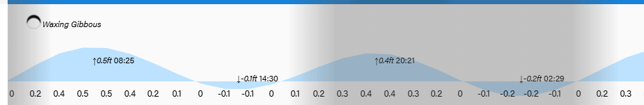
Lowest tides are 2:30 p.m. and 2:30 a.m. as we move into full moon period. Have a great Tuesday!
