
Good morning Bay Islands. Our photo of the day comes from Stacy Bye and shows sunset across from C Level Pizza in West End.
Many of us have been getting some morning showers. Those will stick around through the day and get heavier tomorrow. Rain will continue through Wednesday.
There is reason to believe that Thursday into the weekend will be a bit drier, good news for you folks from the US who will be giving thanks.
We also have a potential tropical system to our south early next week.

We have quite a bit of clouds around at 9:30 a.m. We will have occasional rain showers today, perhaps another inch or so. We will have periods of heavy storms tomorrow. Rain should be lighter again on Wednesday. Thursday looks like it should be nice. There are some differences in the forecast Friday into the weekend, with the Canadian model bringing rain back and the US and Euro models bringing in drier air from the north for the weekend.
Wind and Galaxy Wave forecast: Winds this morning are very light from the west. They will turn to the northwest at 5-10 mph later today with seas staying around 2 feet. Winds tomorrow will be from the north 10-15 mph and seas 3-4 feet north side. Winds Wednesday will start to turn back to the east and get lighter with seas still around 3 feet.
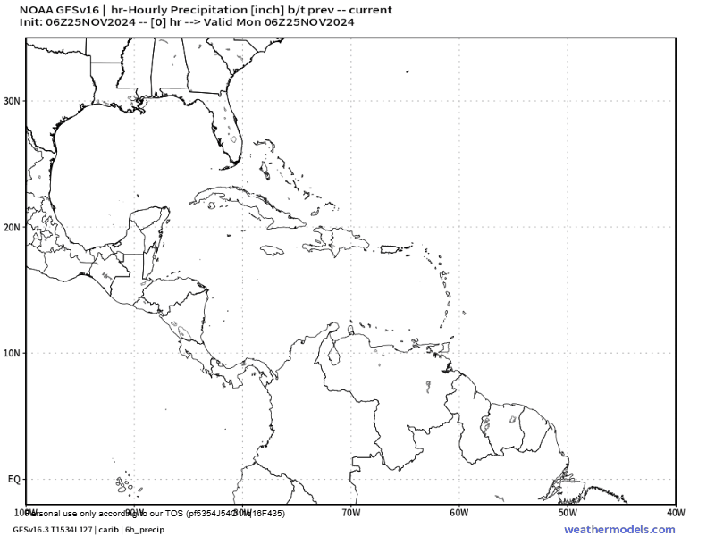
This is the US GFS forecast for the next two weeks. You will notice something spinning up off the coast of Nicaragua sometime Sunday or Monday. Cold fronts keep pushing it to our south. There is some agreement that some sort of tropical system will spin up around Dec. 1 and could increase our showers early next week, but some models keep this system to our south. We’ll keep an eye on it.

For those who will be making turkey for Thursday, you can order your turkey at Rosita’s and pick it up the same day!
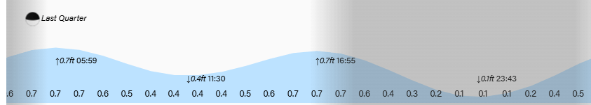
Lowest tide is just before midnight. Have a great week!
