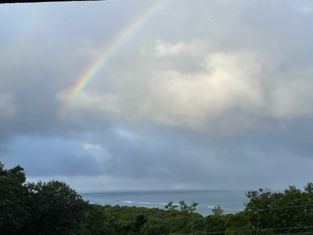
Good morning Bay Islands. We will return with an appropriate photo of the day from Mara Owens in Sandy Bay with a rainbow over Spooky Channel. She reminds us that the rainbow is God’s symbol of peace given to Noah after the flood. We have definitely had a flood: 7-10 inches on Roatan, around 15 inches on Utila. I’ll do a map later today. Hopefully more of the weather stations will come back online as communications are restored. But also, totals are not quite as bad as the worst predictions. I think some areas of the mainland may have gotten it worse.
The storm continues to looks quite ragged on satellite. We are near the center and that actually is a good thing because most of the rain is well to the east and the west. The National Hurricane Center still reports 45 mph maximum sustained winds, but the worst winds seem to be well to our north and even those are only around 30 mph at the surfact. Most locations on Roatan show 10-15 mph winds currently.
We will still have scattered showers today and probably a few more downpours tonight. Most forecasts say 1-2 inches of rain in the next 24 hours, but if you get under the wrong cloud you can get more.
Sunday we may have a few lingering showers in the morning, but we should also see lots of sun with light winds. Monday and Tuesday look nice. Wednesday our winds start to turn to the east in advance of a norther that will bring us north winds 20-25 mph, strong seas northside and rain, especially Thursday evening into Friday.
Seas are 4 feet this morning and should decrease throughout the day and night until they are 2 feet tomorrow.
I will be back later today with an update and rain totals map.

One place that will be open today (the tomorrow in this ad is really for today) is our friends at Ikigai by Robby Molina. If you can make it to French Harbour, enjoy a gourmet meal and share your storm stories with Robby and Melissa.
