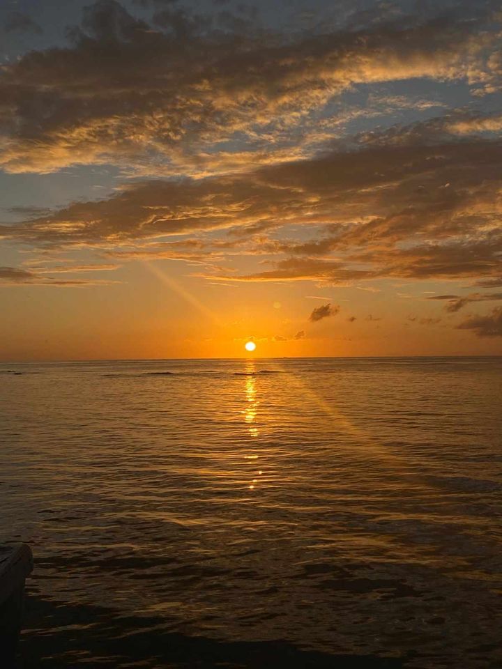
Good morning Bay Islands. Our photo of the day comes from Dethyra Ebanks and shows sunrise at Flowers Bay.
We had quite a bit of rain overnight, especially Guanaja and Utila, which each got over an inch. The week ahead looks less rainy.
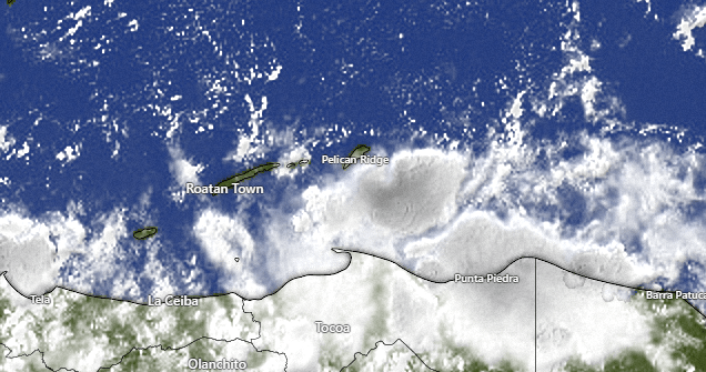
First let’s take a look at our satellite at 7:40 a.m. Most of the rain is now to our south, with a few popcorn clouds, especially over Helene and Barbarat. We will keep a chance of showers around through the morning, but we should stay mostly dry midday and afternoon. Best chances of showers will continue to be overnights and early mornings. As we get to the end of the week, even those should be less and I think Wednesday through Friday we have a good chance of staying dry.
A weak norther should bring us rain and west/northwest winds 10-15 mph next weekend.
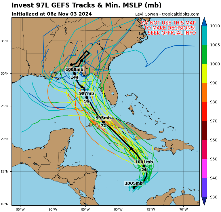
We still have an 80 percent chance of a tropical cyclone forming but the models all agree that it will move well to our northeast. In fact, it may keep us drier than normal by drawing in all the moisture. We will keep scattered showers in the forecast Monday and Tuesday morning, but I don’t expect a whole lot of rain and, as mentioned earlier, the end of the week looks quite dry.
Wind and Galaxy Wave forecast: This morning we have mostly northeast winds 5-10 mph, but we are still dealing with swell that keeps our seas 2-3 feet. As the storm passes north of us, we will keep those 3 foot seasa as the winds turn to the west, but still only around 5-10 mph. Toward the end of the week we will see quite calm sea conditions.

This coming week, especially Wednesday through Friday, will be perfect days for a seaside barbecue with the best meats on the island, custom cut at Carniceria Rosita.
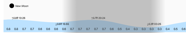
Tides continue to be mild. Have a great Sunday.
