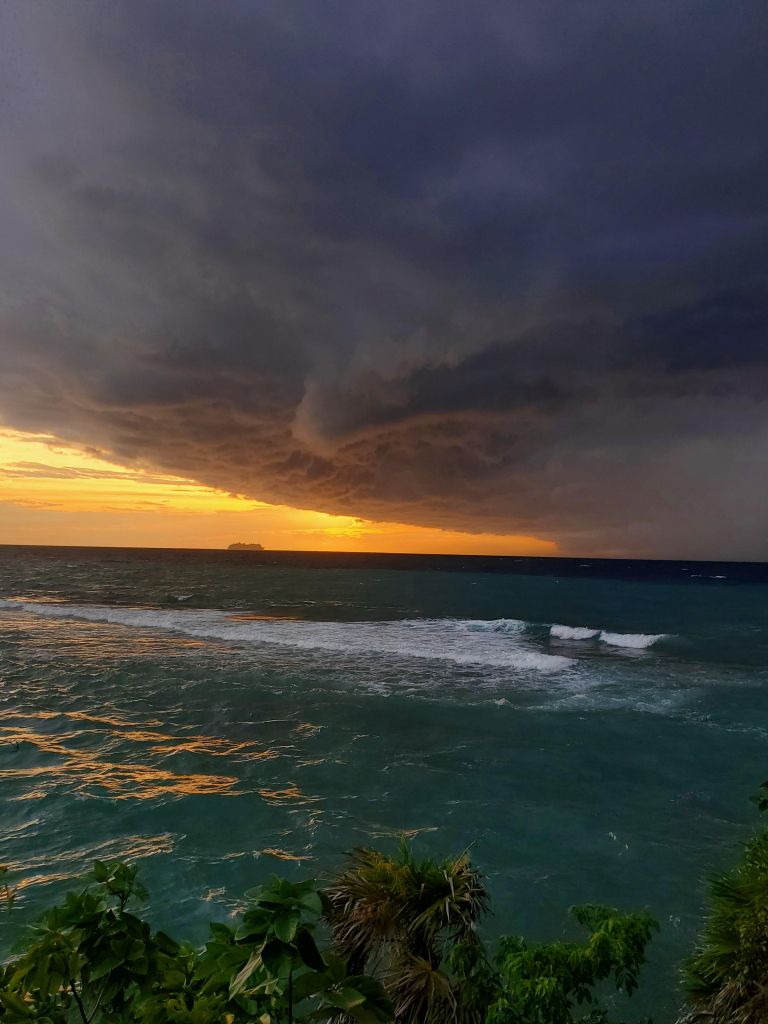
Good morning Bay Islands. Our photo of the day comes from Carla Scramstad in West End who caught this ship heading into the storm. I had at least two others send me photos of this particular storm, but Carla got great definition in the cloud.
Many locations got 2-3 inches yesterday adn as of 6:50 a.m. only Jonesville and Politilly recorded a tenth of an inch. Soon-to-be Hurricane Helene is about to enter the Gulf of Mexico and leave us, but there is an active pattern in the Caribbean.
On satellite at 7 a.m. we can see a very well-formed Helene to our north. We are on the tail end of the storm. There is a small thundershower trying to form to our northwest so we will keep a chance of showers through the morning hours. After that we should go to normal rain chances, mostly overnights and early mornings under partly cloudy skies.
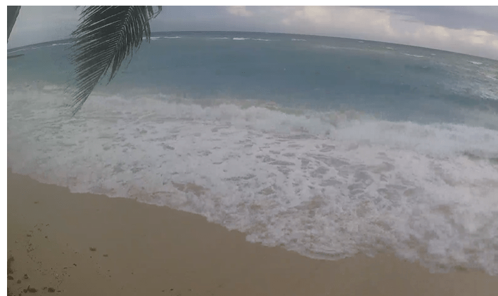
This is a screenshot of the webcam at West Bay where they are having waves 4-5 feet at the reef with 20 mph west winds. Today will be windy and wavy, but tonight things should start calming down. Tomorrow we will have a west wind in the morning around 15 mph and seas around 3 feet, but the afternoon should be calmer, and we will see calmer winds and seas into the weekend.

We’ve been talking about another tropical wave for next week and the GFS is trying to make it another hurricane that would look a lot like Helene, but similar to Helene it shouldn’t be a threat to us for anything more than showers and storm sometime early to mid next week.

Next week is Semana Morazanico and Galaxy Wave has a special week of ferry service for all the trips between the islands and the mainland.
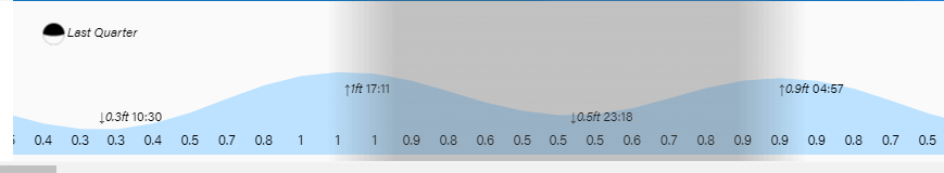
Tides continue to run high. Have a great Wednesday!
