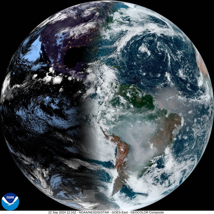
Good morning Bay Islands. Our photo of the day comes from NASA, and shows a satellite image of equinox, when day and night is equal from the north pole to the south pole. Supposedly our day and night should be equal, but like many things with weather, the answer isn’t simple. Our sunrise is 5:35 a.m. and sunset is 5:41 p.m., so 12 hours 6 minutes of daytime. The extra six minutes is because the atmosphere causes the sun to appear to rise six minutes early, so enjoy them.
We are still watching a likely tropical storm near us, but it shouldn’t become a tropical storm until it passes us.
Our close up satellite this morning shows some rain to our west. These storms are mostly stationary, but upper level winds are moving the tops of the clouds from west to east. West Bay and Utila have picked up about half an inch of rain as of 7:30 a.m. BTW, several of our West Bay weather stations are not functioning. I love my weather station owners. If I can assist let me know.

We finally have a red “X” to mark a center of our storms off the Mosquito Coast. We have a 70 percent chance of a tropical depression in the next week and, for the first time, a 10 percent chance in the next 48 hours. You will notice the area marked for development is mostly to our east and north. We don’t have to worry about a tropical storm or hurricane, but we should have off and on rain and storms through Wednesday morning.
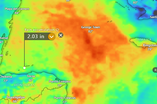
Here is the Euro rainfall prediction through Wednesday morning. Most of the computer models are similar. You can see the heaviest rain (reds and oranges) going to our east, toward the Caymans. Most models have us right around 2 inches through this period. Starting Wednesday we should start clearing out and our weather will become more normal, with rain chances returning to the overnights and early mornings.
Wind and Galaxy Wave forecast: We should stay pretty calm today, with east/northeast winds 5-10 mph and seas 1-2 feet. Starting tomorrow our winds and waves depend on how quickly this storm gets organized. Winds will turn to the west starting tomorrow and perhaps pick up to 15-20 mph and seas likely to 3 feet, especially Tuesday and Wednesday.

Don’t forget that Sunday is Lobster Day at Ikigai by Robby Molina. It’s the best and most reasonably priced Lobster special on the island and it’s only on Sundays so head down to French Harbour!
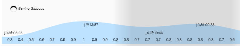
Tides remain relatively high. Have a great Sunday!
