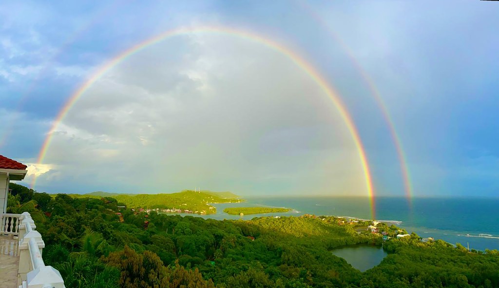
Good morning Bay Islands. Our photo of the day is a double rainbow extending from Jonesville over to Jonesville Point from Alex Fleig. If we don’t see rainbows over the next 24 hours, it will be because we don’t have enough sunlight as clouds and showers from our tropical wave pass over us. After tomorrow morning, rain should lessen.
On our radar this morning at 7:30 we can see the thundershowers we had this morning moving to our west, while another group of storms moves in from our east. These storms should weaken as the morning goes on, but there will be a chance of rain all day under mostly cloudy skies. Tonight there is a 70 percent chance of showers and thundershowers that will last through tomorrow morning. Starting tomorrow afternoon, we should go back to our cycle of 40 percent chances of rain overnights and early mornings and partly cloudy skies middays.
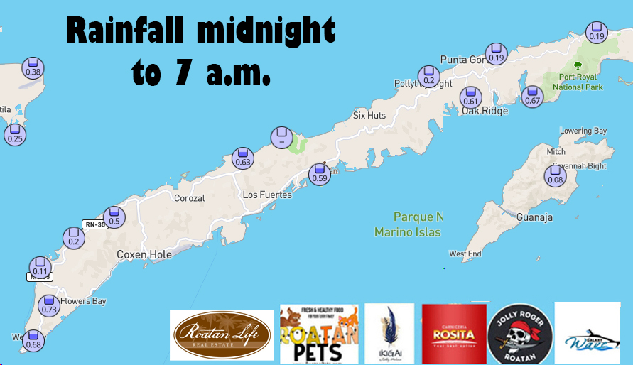
Here are our rain totals from midnight to 7:30 a.m. today.
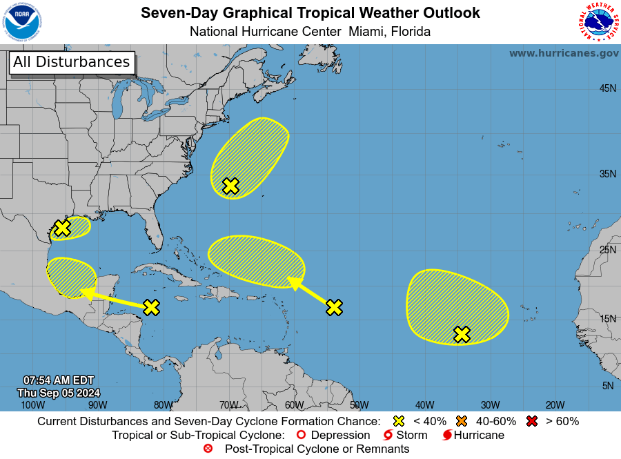
The National Hurricane Center took us out of any chance of a tropical storm. The wave that is passing over us has a 30 percent chance of doing something in the Gulf of Mexico. The other three X’s on this map are not a threat for us, but we can see the tropics are getting a little more active as we move into September.
Wind and Galaxy Wave forecast: We wake up to east winds 5-10 mph and seas 2-3 feet. Seas should be around 2 feet today, but watch out for winds and seas during thunderstorms. Tomorrow and Saturday winds and seas look quite calm. As we get into next week, things will get a bit windier at 15-20 mph east winds and 3 foot seas south side.

Explore Roatan real estate with the island’s top experts at Roatan Life Real Estate. Serving clients since 2001, we offer personalized guidance in buying and selling properties. Trust our dedicated team for unparalleled local knowledge. Start your journey at www.roatanlife.com
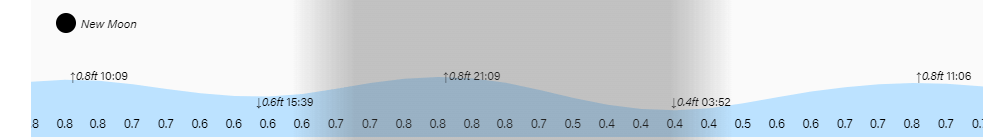
Tides continue to be mild. Have a great Thursday and stay dry.
