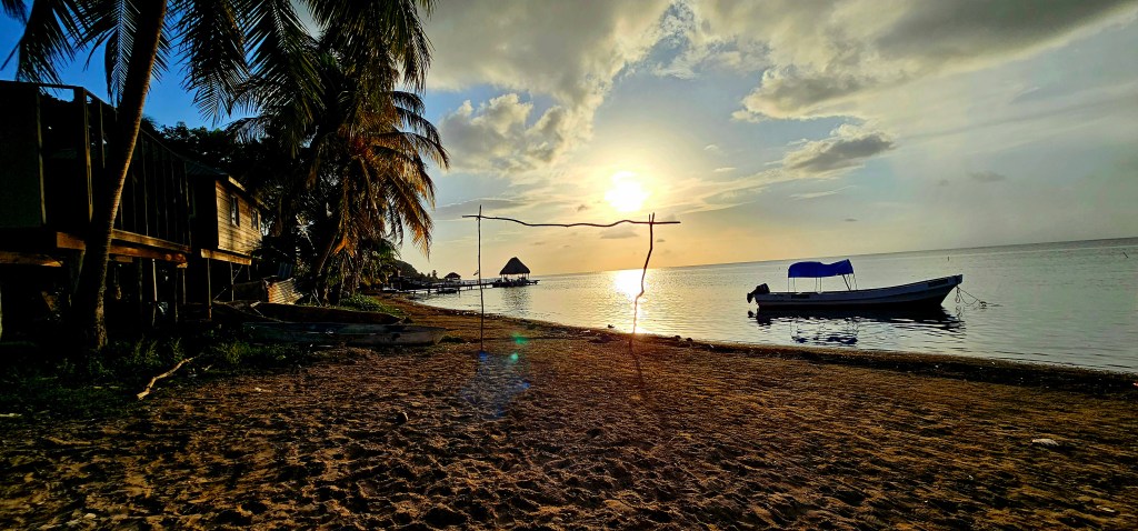
Good morning Bay Islands. Our photo of the day comes from Jacy Richards who caught this sunset on a walk between Punta Blanca and Punta Gorda.
We are still keeping an eye on the system that is located due north of the of Colombia/Venezuela border. Chances are good this means nothing more than showers Thursday night into Friday, but the GFS is forecasting a bit more wind and rain, though still nothing terribly serious for the islands.
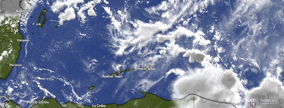
Let’s start with the near-term forecast. Many of us got a shower last night around 10 p.m., with Utila, Guanaja and the west side of Roatan getting about a third of an inch and the east side getting about a tenth. On satellite this morning we can see some showers to our east. As usual this time of morning they are weakening, but we will keep a small chance of a shower through the morning. Today through Thursday we will continue to have small chances of rain overnight and early morning and winds quite mild, 5-10 mph from the east with seas 1-2 feet.
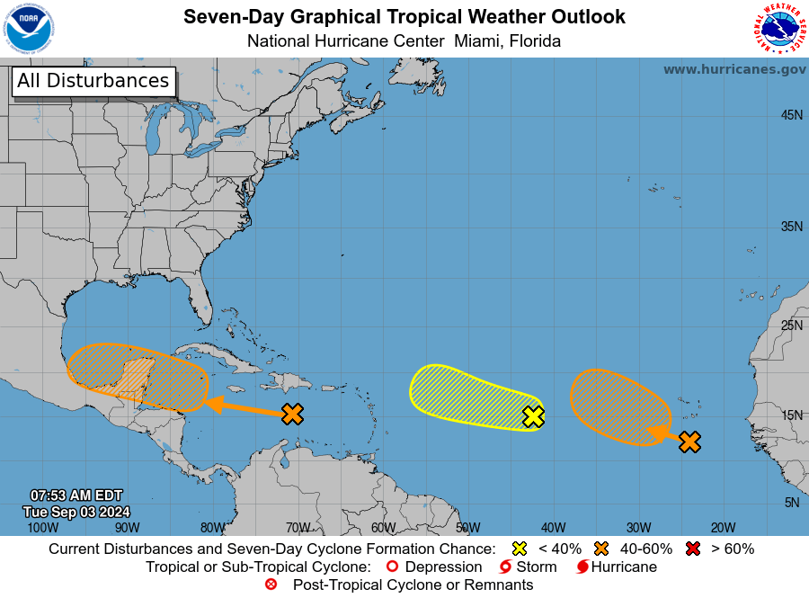
This is the National Hurricane Center forecast. The X on the left is the one we are worried about. The two on the right, if they develop, will go north. The one on the left STILL has a 40 percent chance of becoming a tropical depression, which means we are no closer to knowing what will happen than we were yesterday.
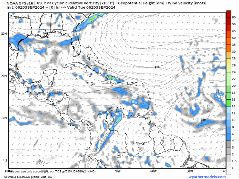
The most interesting possibility is the one from the US GFS. It shows the wave hitting us Thursday night with one round of showers, then reforming to our north this weekend and possibly becoming a tropical storm to our northwest before moving into Belize.
The ICON shows the storm going to our north as a fairly weak tropical depression, perhaps a tropical storm, but giving us minimal effects.
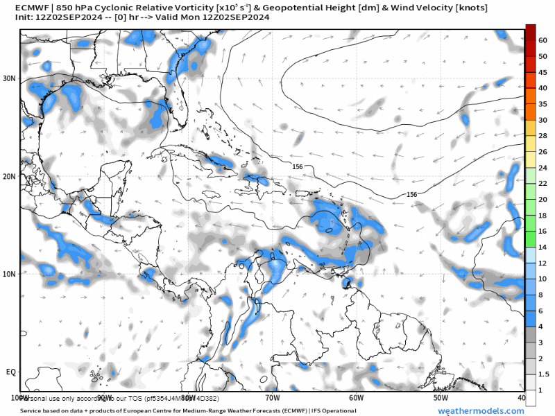
The Euro continues to show just a wave of showers for Thursday night into Friday.

If you are worried about travel plans, you can trust the folks at the Galaxy Wave. If things get too bad, they will cancel and you can use your ticket for another trip. Today through Thursday, though, it looks like smooth sailing.
The most likely outcome seems to be scattered showers Thursday night into Friday and maybe continuing into the weekend. Our winds may pick up a bit Thursday into the weekend, but right now it looks like we’re only looking for winds around 20 mph. But because this area is the area that it could strengthen, we still need to watch for rapid intensification. It is unlikely it will strengthen into a hurricane, but you can never say never. Just ask the folks in Puerta Vallarta.
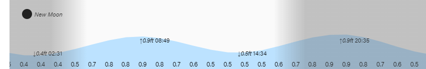
Tides continue to run on the high side. Have a great Tuesday!
