
Good morning Bay Islands. We have a gorgeous sunset sent to us by Guadalupe Alvarez Montserrat as our photo of the day. I think that might be a mermaid in the front of the photo. We have three nice days coming up and then, probably Friday, a tropical wave that the National Hurricane Center has identified as an area for investigation.
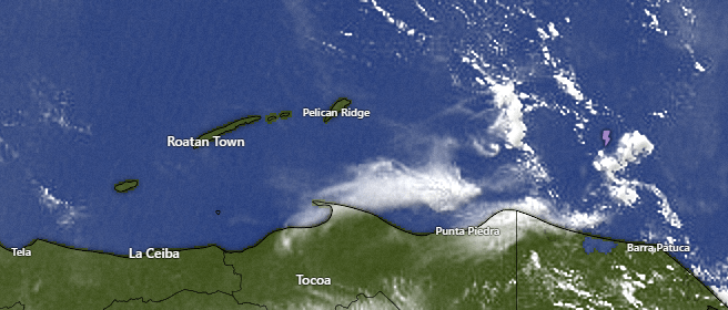
We have clear skies overhead at 7 a.m. and a few popcorn clouds to the east of Guanaja. They are moving west, but it is unlikely they will make it to the islands with any rain. This afternoon we will be partly cloudy and we will have a 20 percent chance of an evening shower.
Tuesday and Wednesday look very similar, as does Thursday, except Thursday we should have increasing clouds as the tropical wave gets closer and gives us a good chance at a rainy Friday and perhaps Saturday morning.
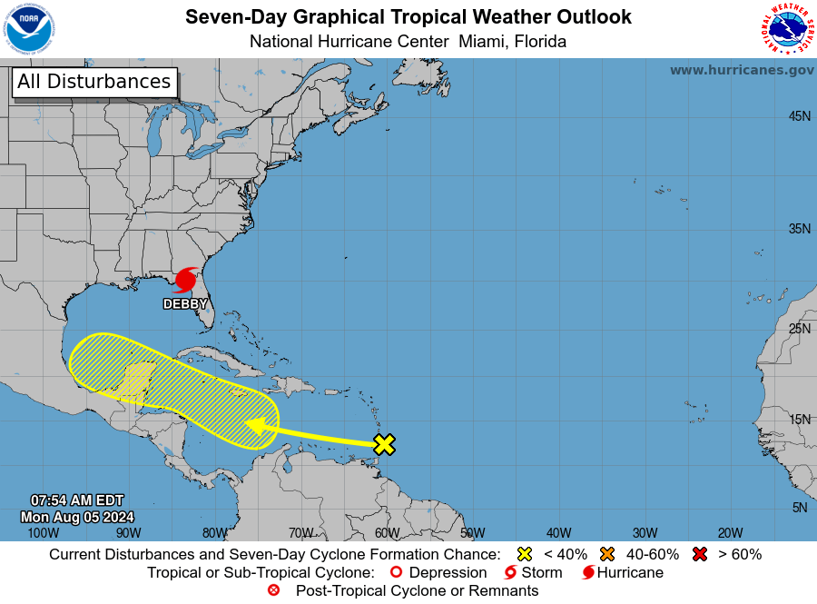
Here is the map from the National Hurricane Center. It shows a 30 percent chance of tropical development (at least a tropical depression) over the next 7 days. The computer models aren’t as strong on this storm as they were two days ago when I did the video on it, but we should still keep an eye on it.
The arrow points to where the storms are now, crossing over the Lesser Antillies.
Wind and Galaxy Wave forecast: We wake up to 10 mph east winds and 2 foot seas south side. Winds should stay around there throughout today, increasing to 15-20 mph east winds and 3 foot seas overnight. Tuesday we will have 15 mph east winds and 2 foot seas. Wednesday and Thursday look quite calm. What happens Friday depends on how the storm develops.

With calm seas it is a great week to take advantage of the special Galaxy Wave is still running — just $25 each way to La Ceiba. Get your shopping and medical visits done before the possible storm comes on Friday.
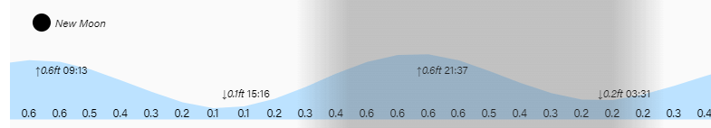
Low tide is 3:15 p.m. Have a great week!
