Good morning Bay Islands. I’m going to suspend the photo of the day until the storm threat has passed, but later this morning I will post the poll so you can vote on June’s photo of the month.
The headlines today:
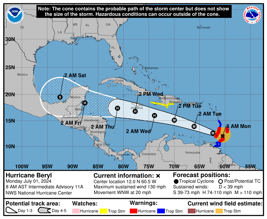
Hurricane Beryl will pass through Grenada within a couple of hours as a category 4.
The latest Euro shows the storm coming closer to us, but only as a tropical storm.
The GFS and ICON continue to show it going further north, away from us, as well as weakening.
Target time for Beryl’s closest pass at the islands is Thursday night.
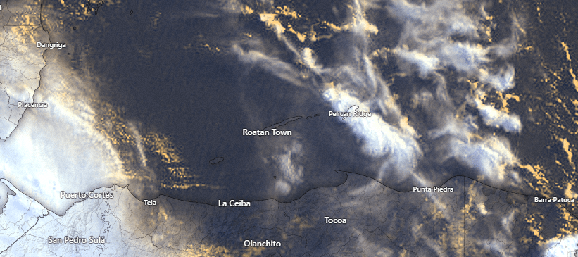
Very briefly, let’s talk about our current weather. On satellite we can see some showers that are moving through Guanaja at 6:30 a.m. They have picked up around a quarter of an inch. These clouds are moving toward the south. It is possible that Roatan, especially the east side, could see chances of showers in the 7-8 a.m. time period. As for the rest of the day, the rain chance will be around 20 percent and skies will be partly cloudy.
Tomorrow chances will be 30 percent and Wednesday 40 percent.
We have east winds 25 mph and seas 4 feet on the southside. As the day goes on we should calm to 15-20 mph and 2-3 feet. Tomorrow winds will be 15-20 mph and seas 2-3 feet. As we get into Wednesday and Thursday morning, seas should be even calmer, as often happens when a storm approaches. Seas should be quite wavy Thursday evening into night, even if the storm is further away, due to swell.
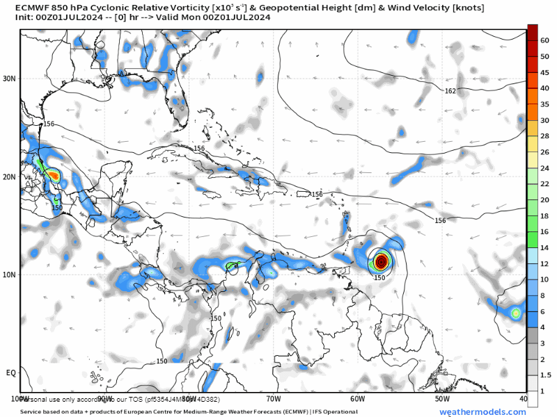
One of the changes this morning is that the Euro is pushing the storm further south. This is a forecast of the spin in the atmosphere and helps us see the center of the storm better. You will see it shows the center of the storm moving just north of us. in the middle of Thursday night
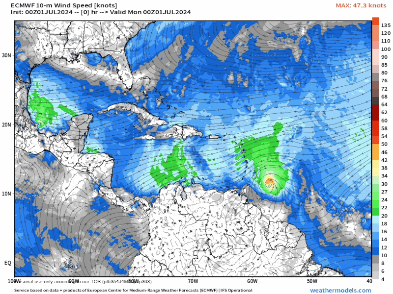
The Euro also shows the storm decreasing rapidly, so it only makes it a tropical storm as it passes north of us Thursday night.
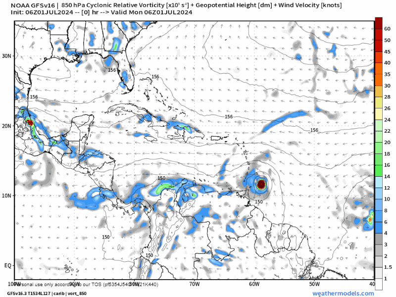
The GFS and ICON both show the storm moving further north, hitting around Cancun. This would be better for us obviously.
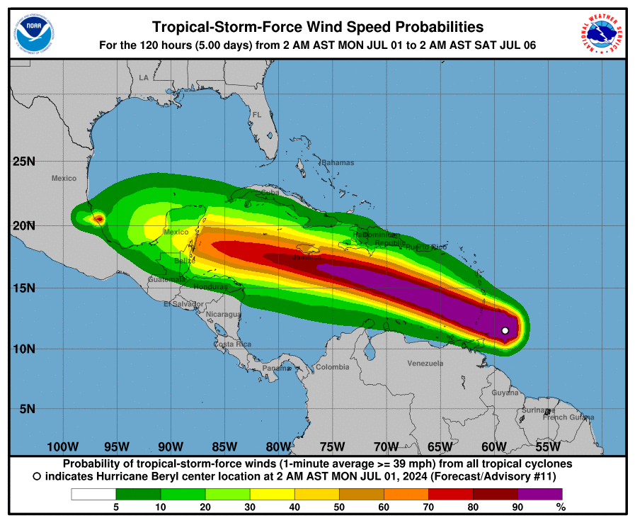
Here are the wind chances according to the NOAA NWS National Hurricane Center. They are giving Guanaja and Roatan a 30-40 percent chance of experiencing tropical storm force winds. We also have a 9 percent chance of experiencing hurricane force (74 mph) winds. Peak wind time will be Thursday evening into Thursday night.
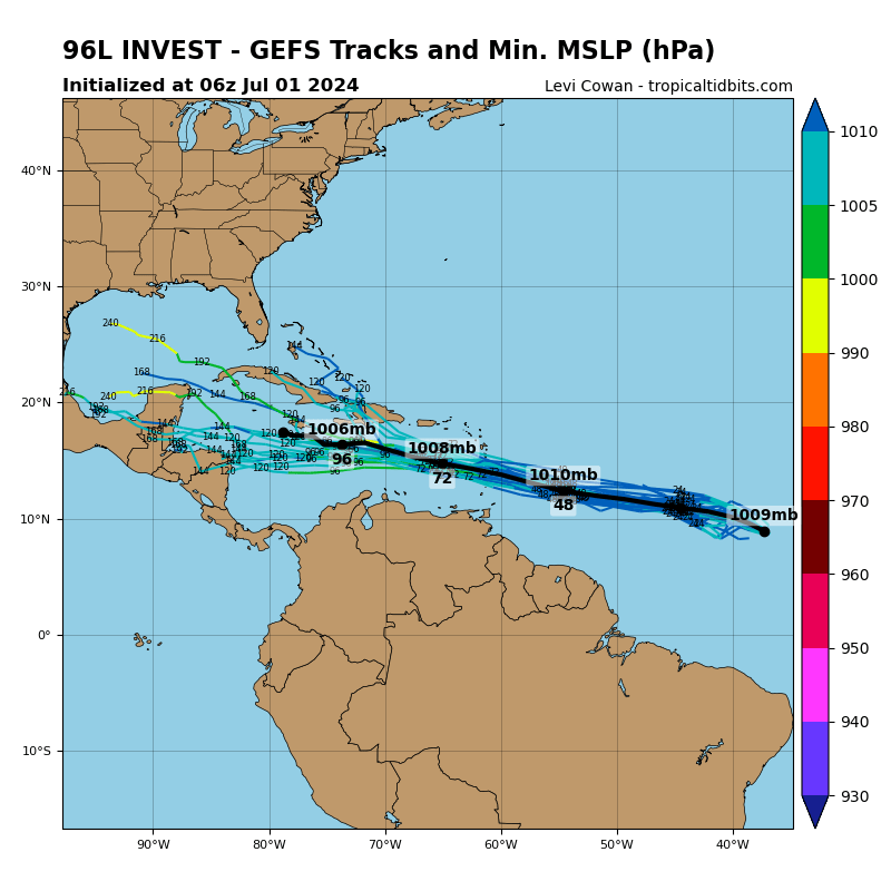
Potential Tropical Storm Debby is still running behind Beryl. It has not yet organized and the NOAA NWS National Hurricane Center has lowered the probability to 60 percent chance that it gets organized. If it does, it should follow behind Beryl and could impact us Sunday, but likely as a tropical storm or just a tropical wave.
If you are a potential cruiser, your cruise line will make sure that your safety is a priority. I expect some changes in cruise schedules this week, if only because the storm in between the US and Roatan. If your ship makes it here, Jolly Roger Roatan will make sure you have the safest, most fun excursion possible.
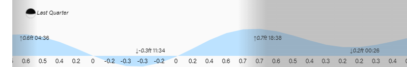
Lowest tide is 11:30 a.m. If you would like to support our work here, go to patreon.com/roatanweather or buymeacoffee.com/roatan. Have a great, and a safe, week.
