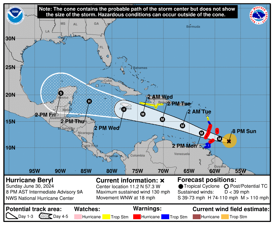
The good news is that the storm is trending in the right direction for us — northward. We are now on the very southern edge of the cone of uncertainty.

It is not impossible for it to come our way, but chances are good it passes north of us, gives us some moderate westerly winds on Thursday and choppy seas west and north sides Thursday night and Friday morning.
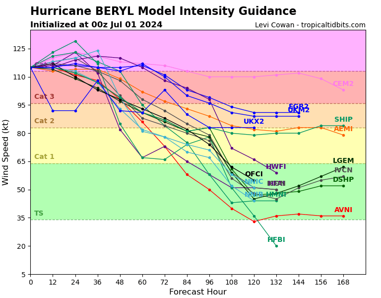
Hour 84 on the intensity chart is when Beryl will make its closest pass to us.

You would be forgiven for thinking this was the path chart for Beryl about three days ago, but no, it is Invest 96L, potentially Tropical Storm Chris. It is following a similar path to Beryl. The one good thing about the future Chris is that Beryl should churn the waters a bit in front of it, given it a little cooler waters and perhaps a little less hurricane fuel. If it comes toward us, Sunday is the day to watch for.
