Good morning Bay Islands. We aren’t going to do a photo of the day, but tomorrow will be the contest for the winner of a free dive at Sandy Bay Divers. Here are the headlines:
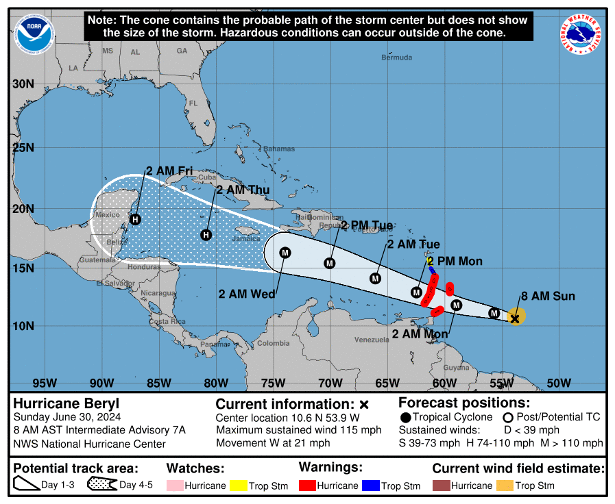
1. I feel a lot better today than I did yesterday that we will not take a direct hit. It is still a possibility, but the majority of models are agreeing that this will pass north of us. The south side of a storm is the weaker side. Depending on how far north of us it goes, it is still possible we see minimal effects.
2. The trend with this storm is that it will be stronger when it get around here than previously thought. Right now the best estimate is Cat2 100 mph, but this is an unprecedented storm this early in the season and a bigger storm is not out of the question.
3. The Euro has this coming closer to us, giving us 8 foot seas on the north side Thursday evening. Other models have it going further north and less impact on winds and seas here. Still, there is a good possibility of a stormy Wednesday night through Thursday night.
4. This is a relatively fast-moving storm, so that is a good thing no matter where it goes.
Let’s take a moment to be amazed at how well-formed this storm is. It is the earliest Category 3 on record with 115 mph winds. It is the first such storm east of the Windward Islands in June. It is the earliest Cat3 in June since 1966. This year is definitely going to be different than previous years, more dangerous for everybody.
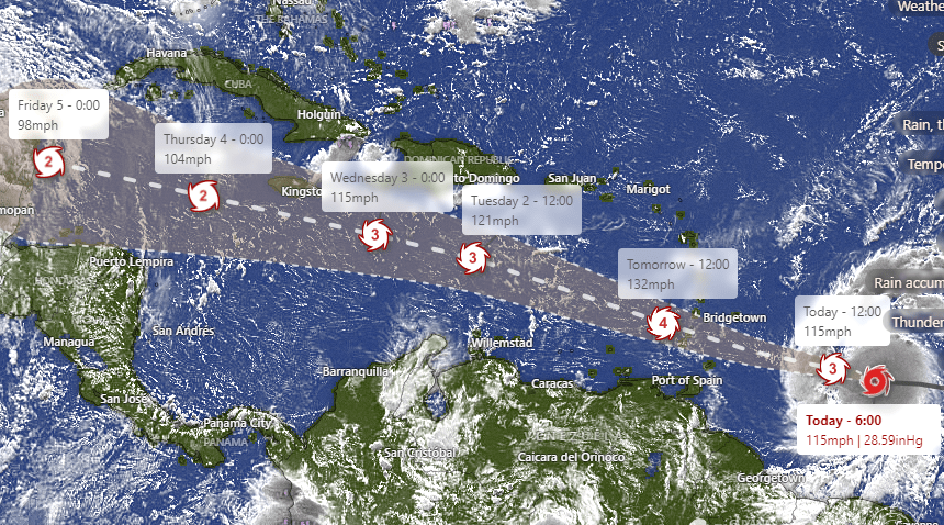
Here is the projected path with expected max wind speeds. Keep in mind the max wind speed is a small area near the eye of the storm. The most dangerous area of this storm will be right near the eye and the next most dangerous area will be north and east of the eye.
Forecast today through Wednesday. We wake up to 25 mph southeast winds and seas around 4 feet southside. Today we will have 20 mph east winds and seas around 3 feet and tonight we’ll be back up to 25 mph east winds. Tomorrow and Tuesday will be a bit calmer with winds around 15 mph and seas 2-3 feet southside.
Today will be mostly sunny. Starting tomorrow we will have a small chance of a stray shower, Tuesday a 30 percent chance and Wednesday increasing clouds and showers as the storm starts getting closer.

Want to enjoy the calm before the storm? Go get you some lobster at Ikigai by Robby Molina in French Harbour. Best deal on the island with a top100 chef, an unbeatable combination.
If you want to support the work we do here, check out patreon.com/roatanweather or buymeacoffee.com/roatan
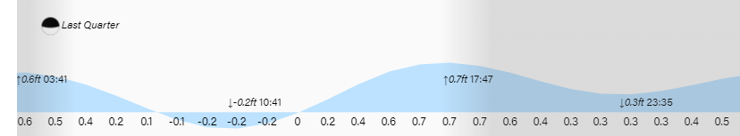
Low tide is 10:40 p.m. Have a great Sunday!
