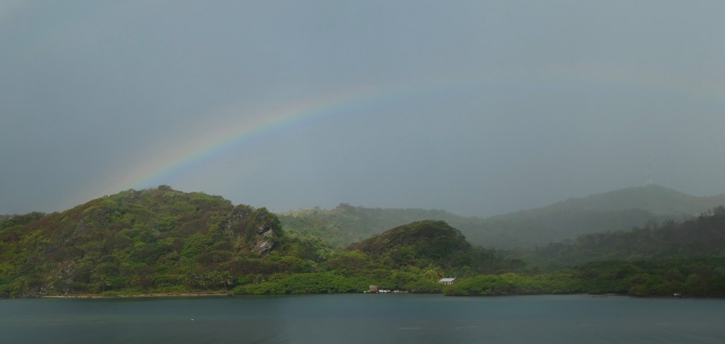
Good morning Bay Islands. Phil Sikora got this rainbow yesterday over Carib Bight and we had the better chance of seeing one on the east side of the island, with most of us getting about 2/3 of an inch yesterday. West Bay and West End practically missed out with .10 of an inch while Sandy Bay to mid-island got 1/3 of an inch. Guanaja got half an inch and Utila also got a third of an inch. This morning we are mostly sunny, but a few of us picked up .01 of an inch around daybreak. There are rain chances this afternoon into tonight, but the big story is what we’re watching for next Friday.
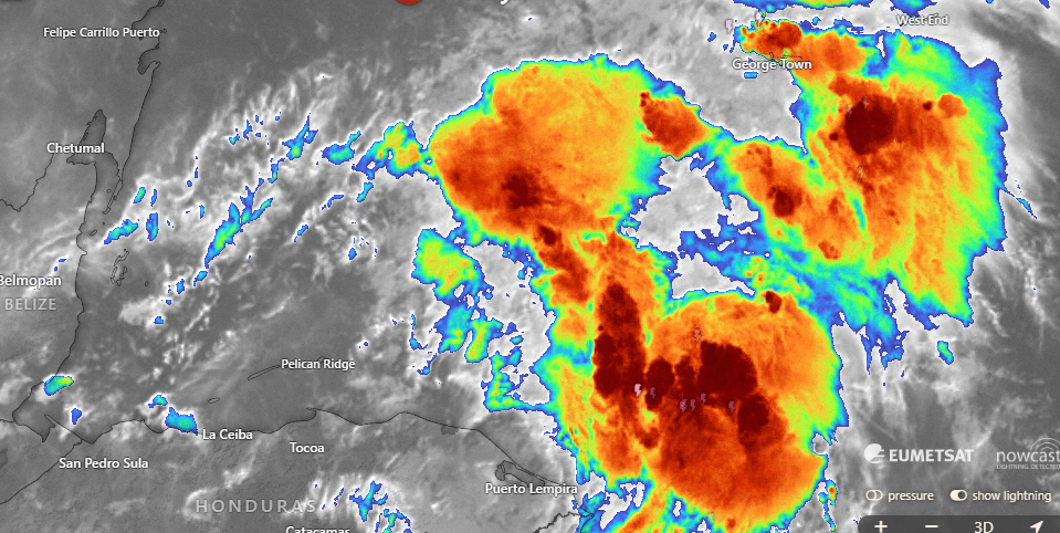
As you can see, the rain from our current tropical wave is mostly to our east. It will move to the northwest and there’s a chance it will miss us to the north. Still, we will keep a 50 percent chance of rain, especially for late this afternoon into the early nighttime hours. There will be a small chance of rain tomorrow morning, but the weekend looks mostly dry and partly cloudy. Monday through Wednesday we will have 30 percent chances of showers, especially in the mornings.
Wind and Galaxy Wave forecast: Today will actually be quite calm, with light and variable winds and seas 1-2 feet. If we get a squall this evening, of course there might be wind with that. Tomorrow should start calm, but east winds at 20 mph and seas at 3 feet should return around midday tomorrow. We’ll keep those 15-20 mph east winds and 3-4 foot south side seas into early next week.
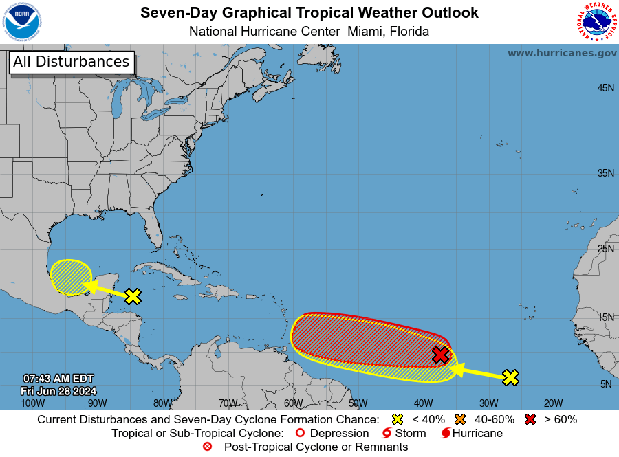
We have a little yellow x almost directly over us, but at least this morning we are missing out on the rain, which is mostly to our east and northeast. But of more serious concern is the red X still in the middle of the Atlantic. Models are unanimous that this will become a hurricane and that it will come toward us.
Let’s start with the bad news. The Euro is forecasting the worst possible path for this storm (currently known as 95L), splitting the gap between the Bay Islands and the mainland. Fortunately, we are a week away and this path will certainly change, but the storm is generally coming toward us and any impacts on us would come next Thursday night into Friday.
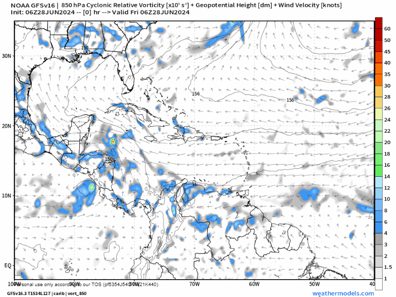
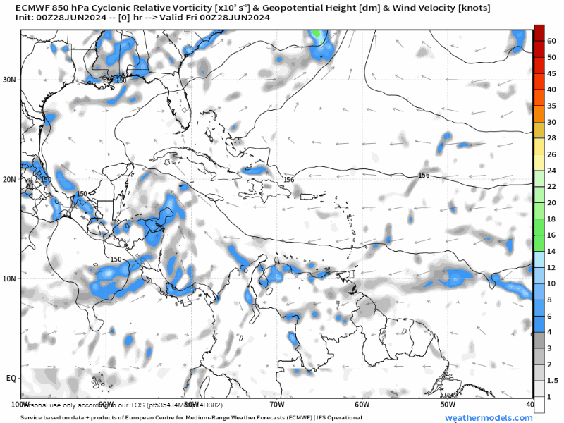
The GFS path is better for us. It moves the storm more north, toward Cuba. If it takes this path, it would have little to no impact on us. Notice the storm right behind it. That is the yellow X in the Atlantic on the NOAA NWS National Hurricane Center map and is also a storm to watch, though it should be weaker than 95L.

Here are the various paths that different computers within the GFS model predict for the storm. You will notice that the storm is expected to strengthen in the eastern Caribbean, but weaken somewhat as it nears us due to wind shear.

The forecast strength for the storm peaks around Tuesday in the eastern Caribbean, probably as a category 1 or 2, but weakens as it moves our way. If it comes toward us, it would be at the end of this graph, around hour 168, and by then it might even degrade to less than a tropical storm. Let’s hope so, but our water temps are quite warm and the wind shear forecast may change, so nothing is certain.

If you decide to stock up this week, don’t forget to include your pet in your safety plans, including having plenty of locally-sourced and highly nutritious Roatan Pets food.
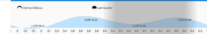
Low tide is 8:40 a.m. Have a great Friday.
