
Good morning Bay Islands. Our photo of the day comes from Cesar Gonzalez Sr. taken from Pristine Bay looking east. We don’t get many nighttime photos of clouds, but I like this one because it shows first light of dawn coming through wispy cirrus clouds that have no rain.
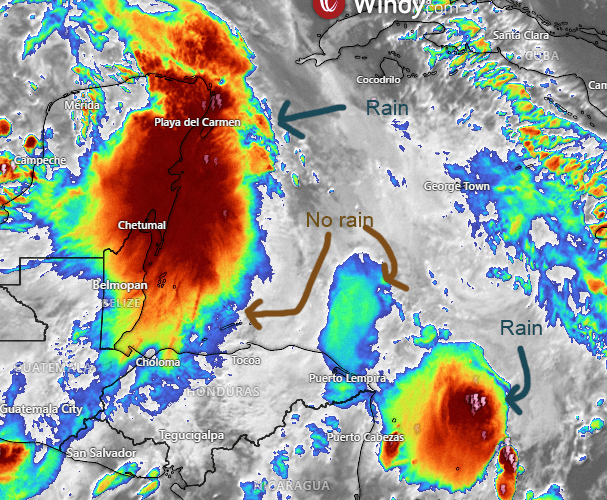
This is the infrared satellite image, which gives the higher, colder cloud tops colors leading from blue to red. When I first started looking at these satellite images I was fooled into thinking the whole red mass held rain, but in these large cumulus clouds systems, the rain is usually only in the highest cloud tops. We’ve spent a lot of dry time under the lower cloud tops.
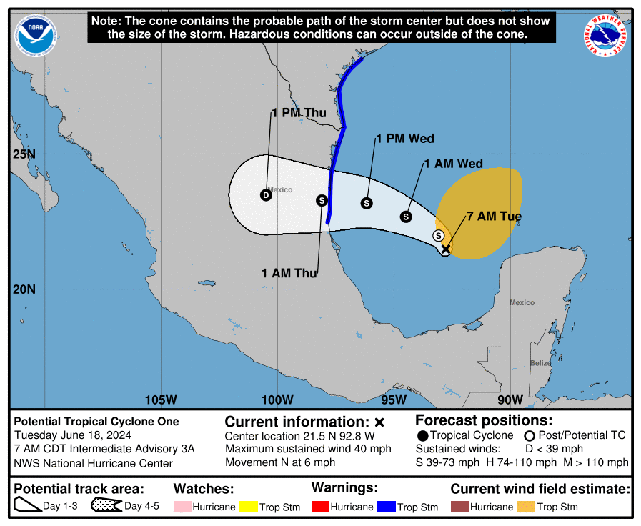
Here’s the path of what should be Tropical Storm Alberto. It won’t directly affect our weather, but it might indirectly drag some moisture over us.
This video shows why we have hope for rain tomorrow into tomorrow night. As what should be Tropical Storm Alberto moves ashore in northern Mexico, moisture shown as the X will be dragged behind it over us. It gives us hope, but it’s not a sure thing. The GFS and Euro, usually two of the more reliable computers, say this will happen. The German ICON and the Canadian model keep us drier. Let’s hope it happens, because the weekend into early next week looks dry.
Wind and Galaxy Wave forecast: We start the day with 15 mph southeast winds and seas around 3 feet south side. As we get to midday that should calm to 10 mph east winds and 2 foot seas. Tomorrow morning will be again 15 mph southeast winds and 3 foot seas south side, but Wednesday evening through Friday morning will be quite a bit windier, with southeast winds 20-25 mph and seas 4-5 feet.
No matter what the sea conditions it’s always a great time to book your excursion with Jolly Roger. They will find the best spot to go in the water and a great time on the boat as well.

Low tide is just after noon. By the way, the airport hit 95 degrees (35C) yesterday. That’s the hottest I’ve seen in a long time. Have a great Tuesday!
