
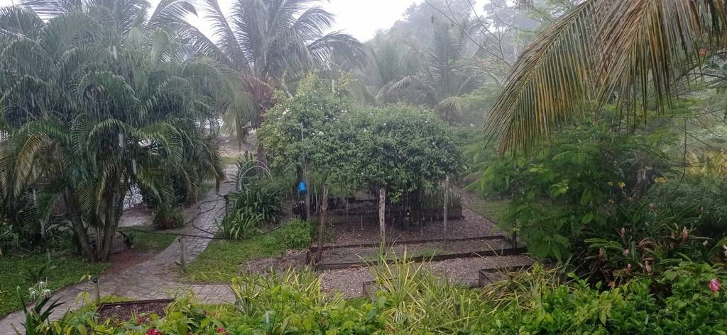
Good morning Bay Islands. Our photo of the day comes from Jason Farmer in Camp Bay and shows some rain on the horizon, especially on the right side of the photo. We had some reports of some sprinkles in Big Bight and Paiz Sloane picked up .15 of an inch on Guanaja. YAY!!!! This is hopefully previews of coming attractions. We have a storm system off the Nicaragua coast that may send some energy our way over the weekend. And we have unlimited visibility today. I think we are over the smoke for this year.
Just as proof that it really rained, here is the photo from Annette Huskin on Guanaja. With all the rain to our east, the further east you are, the better your chance of rain. Let’s hope we can get some more further west.
Wind and Galaxy Wave forecast: We start the day with 20 mph east winds and seas 3 feet southside. Midday winds will calm to 15 mph from the east/northeast. Through Saturday we will have similar winds, but starting Sunday and into next week we will see the winds calm a little each day until they are almost flat calm by the end of the week.
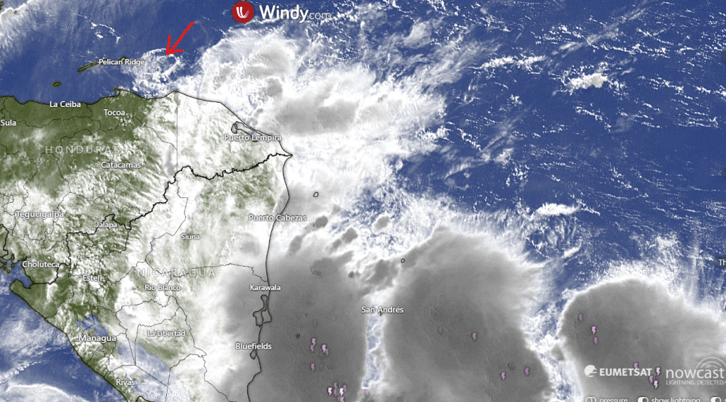
Here is the satellite today, and you can clearly see the strong storms near Nicaragua, but the arrow points to a small impulse of energy coming off the storms toward us. It is weakening and probably won’t be a lot of rain when it gets here, but at least there’s some hope. Rain chances will be best this weekend, with around a 25 percent chance of rain. After that we will still have chances of morning showers, around 15-20 percent each day next week.
With clearing skies, it is a great time to head over to Ikigai by Robby Molina for a meal on their back porch with a great view of French Harbour.
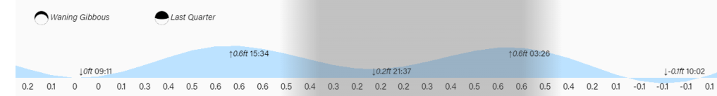
Lowest tide is 9:11 a.m. Have a great Thursday!
