
Good morning Bay Islands. Our photo of the day goes a slightly different direction this morning. Glory Cone sends us this young man in Punta Caliente near Pandy Town enjoying a fresh tortilla. Our visibility this morning is 6000 meters, which is better than it has been in probably two weeks. An upper air flow from the northeast is helping push away some of the smoke, but I’m also suspecting they’re running out of fields to burn on the mainland.
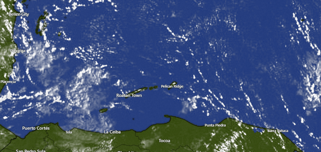
Our satellite this morning shows some smoky haze still, especially to our southwest, but it also shows a few popcorn clouds, the kind that can occasionally give us a small shower. We’re hoping these increase, especially starting one week from today, giving us better rain chances, especially in the mornings.
Wind and Galaxy Wave forecast: We start the day with 15 mph east winds and seas 2-3 feet. We will continue to have mild east winds 10-15 mph during the day with 2 foot seas south side and 15-20 mph east winds overnights with 3 foot seas. These conditions will continue through the weekend.
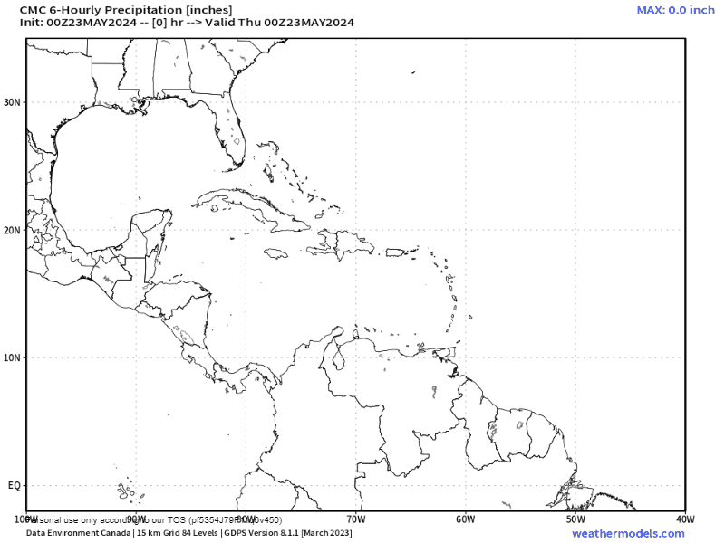
The GFS forecast still strongly believes we will get some rain starting a week from today. Other models have been more conservative. I’m including the Canadian model. It gives us some chances next week, maybe 20 percent each morning. That’s better than the zero we have now, but not as aggressive as the GFS model.

Our Tigre is an island rescue kitty and Roatan Operation Animal Rescue does great work helping needy pets find the right humans. That work is supported by Mitch Cummins at Roatan Pets. If you want to find locally sourced food designed for your pet, whether he comes from the island or from some other place.
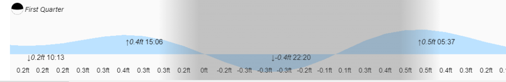
Low tide is 2:15 p.m. Have a great Thursday!
