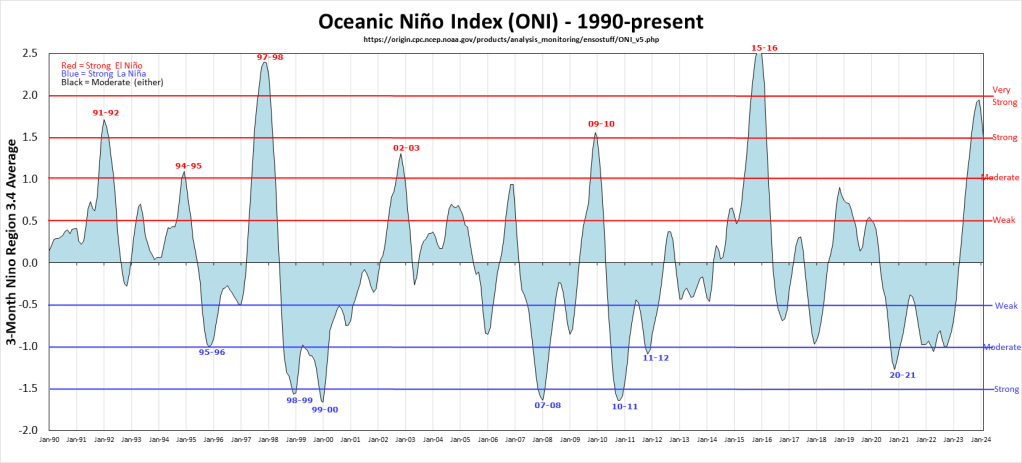
One of the big questions people want answered is “How likely is my vacation to the Bay Islands to be interrupted by a hurricane?” The answer is usually not very likely, but let’s take a look at how we might be impacted by La Niña, which is expected to cool the Pacific waters by late summer into early fall of this year, 2024. Here is a chart of the fluctuation between El Niño and La Niña. We are coming out of a strong El Niño that gave us scorching temperatures and hot waters last year, but no real hurricane threats. By contrast, strong La Niñas tend to cut down on the wind shear in the Atlantic, which gives storms a better chance to build. This chart shows our most recent strong La Niñas were 2007, 2010-11 and 2020. Keep in mind that we think we are headed for La Niña by late summer early fall, but we don’t know how strong it will be.
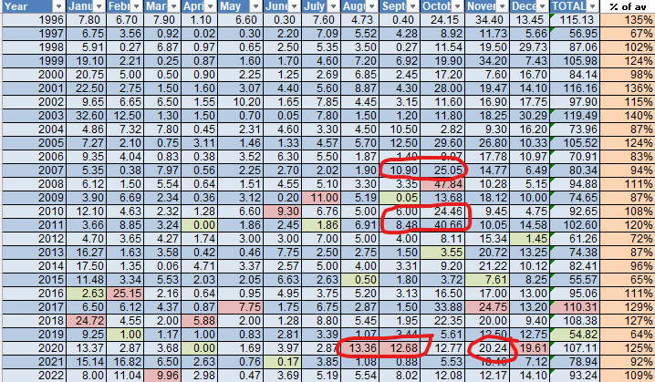
Now let’s take a look at recent La Niña years and the effect it has had on our rainfall. Except for 2020, I wasn’t here during these years, but if we got a lot of rain in August, September or early October, chances are good that we were affected by the remnants of a hurricane or tropical storm. We see that trend for recent strong La Niñas in 2007 and 2010-11. I was here in 2020 when our last hurricane season brought Eta and Iota that devastated the mainland and brought us some rains in November. Hurricane Nana also brought us good rains in August-September of that year. So the setup for a strong hurricane season in the south Atlantic/eastern Caribbean is there. We just have to wait and see how strong the La Niña is. Keep in mind our peak season for hurricanes runs late August into early November.
