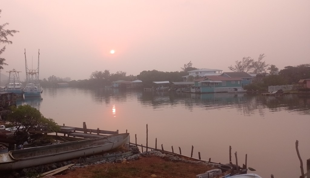
Good morning Bay Islands. Our photo of the day comes from Marcey McNab in Oak Ridge and perfectly captures the smoky haze we’ve been dealing with. Fortunately we have a cold front coming tomorrow just in time!
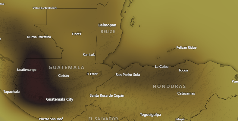
This is a map showing the levels of carbon monoxide in the atmosphere. CO is produced by burning and we have a lot of it in our air. This can mean breathing issues for sensitive folks, so one more day of caution outside before our front comes to clear our air.
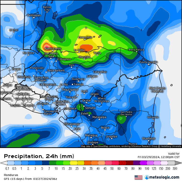
Today will be hazy and hot. Yesterday we got to 90 at the airport and many of us got a little higher than that on our thermometers. I hit 92 here in Jonesville Point and Sandy Bay hit 93. These are unheard of temps for March around here. Fortunately we will have relief with clouds and rain tomorrow, followed by the north wind Friday. Rain will be off-and-on with perhaps some thunder. Rain will start around 6 a.m. and scattered showers will be around through the night. Rain should come to an end Friday morning. We should get 1-2 inches across our islands. Most of Good Friday and Saturday will be sunny and dry. There will be a small chance of a morning shower Sunday morning.
We will have west winds 10-15 mph this morning, but those should calm this afternoon. Tomorrow we will have west/northwest winds 15-20 mph and gusty in squalls. Friday we will have north winds 17-22 mph and seas 5 feet on the north side, calming slightly in the afternoon. Saturday winds will be much lighter from the east, 5-10 mph. Sunday we get a return to strong easterly trade winds.

Just a reminder that there is a special midweek ferry to Guanaja this morning and an extra roundtrip to the mainland on the Galaxy Wave!
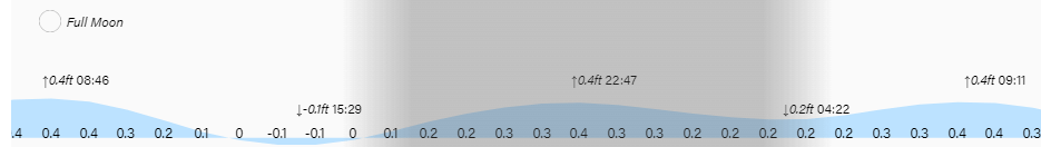
Low tide is 3:30 p.m. Have a great Wednesday!
