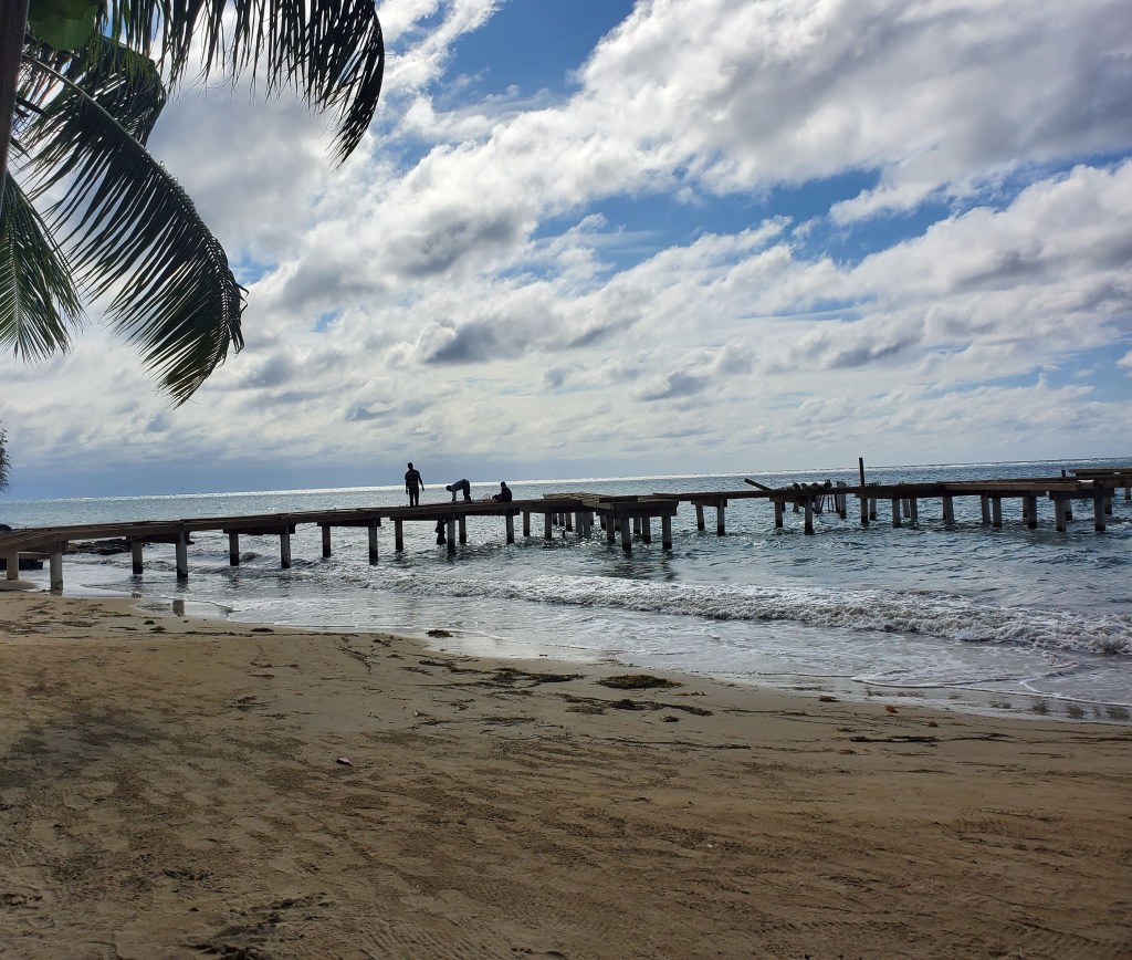
Good morning Bay Islands. Our photo of the day comes from Christine Barry in West End and I chose it because it shows a few more clouds. We are hoping for more clouds starting tomorrow to provide us a little relief from the heat and maybe a small shower here or there.
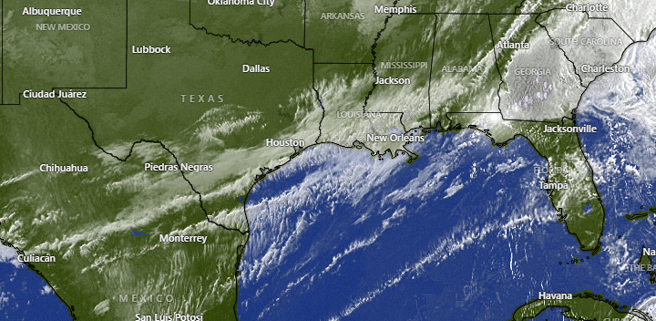
Here is the satellite image of the cold front that will push a few clouds our way starting tomorrow.
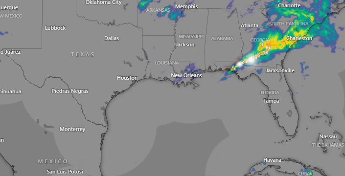
You can see on US radar that almost all of the rain action is on the east side of the cold front. The west side is pretty dry and that’s the side we will get tomorrow and Monday. We will have a small chance of rain, especially tomorrow morning. That is better than the no chance of rain we’ve had the last week. Monday is our best shot at getting a morning shower. There will also be a small chance of a shower Tuesday morning. After that our rain chances go back to near-zero.
Winds today are starting out from the east 15-20 mph and seas are 4 feet on the south side. They will calm today to 10-15 mph and seas at 3 feet. Winds late this evening will turn to the northeast at 10-15 mph overnight. Tomorrow winds turn to the west around 15 mph and seas calm through the day from 2 feet in the morning to 1 foot in the evening. Monday looks like quite a calm day before east winds pick up again Tuesday into next week.

Galaxy Wave is offering an $18 discount on roundtrip tickets to La Ceiba. You can purchase now through March 23 on tickets good for travel within 2024. Go to roatanferry.com for more info.

We’re moving into new moon phase. Low tides are 2 p.m. and 2:30 a.m. Have a great weekend.
