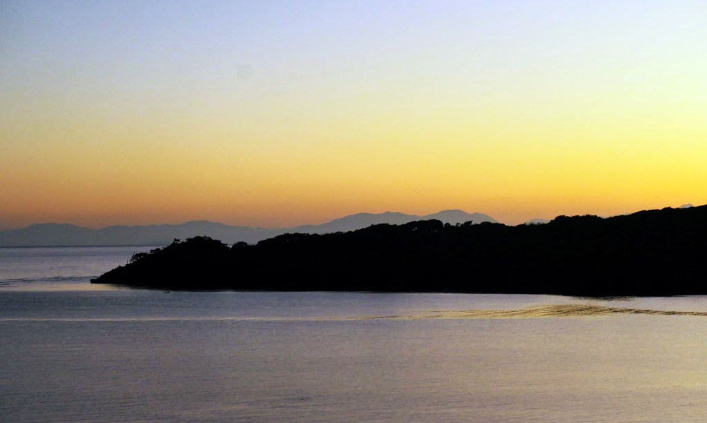
Good morning Bay Islands. Our photo of the day comes from Phil Sikora and is taken from Carib Bight just below Juticalpa here on the east side. I chose it because it shows the mountains of the mainland in the background. You need a clear day to see the mainland and in my experience I would say we can see it clearly about 40 percent of the time. As you look southwest from the east side and due south from the west side, you see the mountains of Nombre de Dios National Park (what a great name for a park.)

Rainfall forecast: Today will be sunny and dry. The map I posted here is for tomorrow morning, and it shows a cold front that brought tornados to the panhandle of Florida today moving out to sea. But as you can see, the tail end near our islands is very weak, so our chance of rain is very low, but not zero. I’ll say we’ll see more clouds tomorrow morning and about a 20 percent chance of catching a shower. After that it is dry until Sunday when another weak cold front comes near. After that it is dry until Wednesday, when we get a better chance of a good cold front bringing rain.
Wind and wave forecast: We start the day with east/southeast winds 15-20 mph and seas 3-4 feet. As the day goes on winds will calm to 10-15 mph and seas 2-3 feet. Tomorrow winds turn to the west around 10 mph but seas will still be from the east 2-3 feet, especially for Roatan and Guanaja. Utila may see seas turn a bit to the northwest, but should only be 2 feet in the morning and 1 foot in the evening. Thursday starts out quite calm, but Thursday night into the weekend, winds and seas pick up from the east.
We’ve seen a good response to Roatan Pets. It’s a great product and don’t forget that 10 percent of proceeds goes to rescuing the needy pets on the island. Contact Mitch Cummings for more info at +504 9801-7828 on Whatsapp.
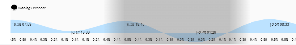
Low tide at 1:30 a.m. will be very low. Have a great Tuesday!
