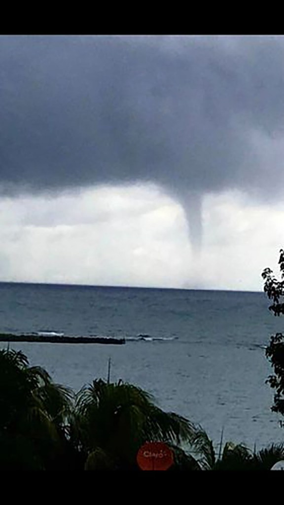
Good morning Bay Islands. Our picture of the day comes from James Oden and shows a waterspout from Nov. 1 off Sandy Bay. Waterspouts are an interesting phenomena. While tornados are almost unheard of in our region of the tropics, waterspouts are fairly common. They form and disappear quickly and create winds generally less than 65 mph, much less than a land tornado. While I’m not forecasting waterspouts, we are in for a windy, rainy couple of days.
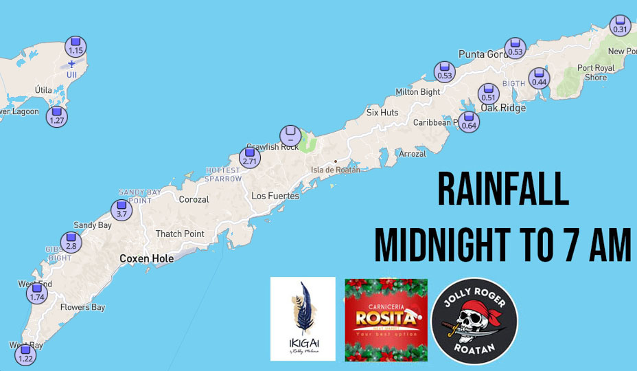
Around 3-4 a.m. we got a heavy rain, especially on the west side of the big island.
We’re actually kind of fortunate, because most of the rain has fallen to our north this morning. Today will be a day of off and on showers. Heaviest rain should come tonight and tomorrow morning.
Here is the wind map going from 1 p.m. today through Monday morning. Today we will have north winds 10-15 mph, with wind gusts in squalls. Tomorrow morning winds should be around 15-20 mph but the real gusty winds come in the afternoon when wind gusts 30-35 mph will be coming from the north/northeast. Winds Sunday are back to 17-22 mph a little more from the northeast and Monday 12-17 from the northeast. By Tuesday winds start turning to the east.
Here is the Euro wave map from midday today into Monday afternoon. Waves right now are around 3 feet coming from the north/northeast. They build to 4-5 feet by nightfall, 6 feet tomorrow morning and 8-9 feet tomorrow afternoon on the north side. Sunday they calm to 5-6 feet and Monday 4 feet, coming more from the east/northeast.
Rainfall will be off and on today with cloudy skies. Tomorrow rain will be heavy and long-lasting for much of the day with 2-5 inches expected. Sunday and Monday rain will be light, but chilly when it falls with more peeks of sunshine.
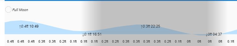
Low tides are 4:50 p.m. and 4:40 a.m. Be careful out there and mostly stay off the seas tomorrow and perhaps Sunday. I often tell people I’m not a boating expert, but 7-8 foot seas don’t sound like fun.
