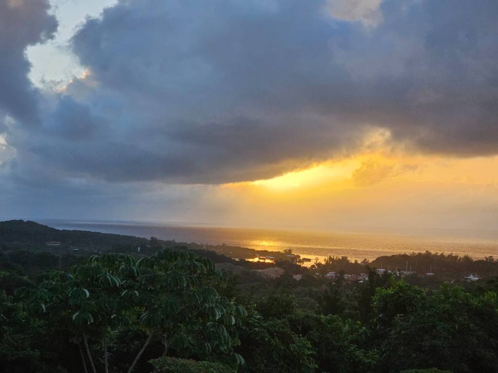
Good morning Bay Islands. This morning we feature a photo from Matt Harper taken … this morning. A small shower was spotted looking northwest toward Fantasy Island near French Key. It is a good photo for the day because we are going to be seeing an increase in scattered showers through Thursday morning, especially starting tonight.
This morning we are seeing a few “popcorn” clouds that may contain small showers like the one Matt photographed. Today rain chances will be quite small, maybe 20 percent, but rain chances will be good this evening through tomorrow morning and we will have scattered showers around through Thursday morning, especially in the overnights and morning hours.
Winds this morning are 15 mph from the east and seas are 2-3 feet and will remain that way through Thursday morning, though toward Wednesday seas may pick up to 3-4 feet, especially on the south side as a cold front stalls to our north. I think our chance for a heavy rain shower is best Wednesday night into Thursday morning.
After Thursday morning our rain chances go way down into the weekend, but our east winds pick up to 20 mph and 25 mph at night, giving us seas 4-5 feet, especially on the south side.
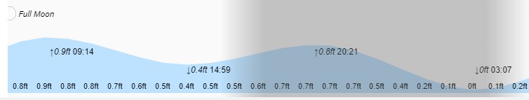
Lowest tide is 3:07 A.M. Have a great week!
‘ve had some followers ask for a text only email with no pictures, especially for those with satellite internet connections out to sea. If you would like to be included please send me your email address.
