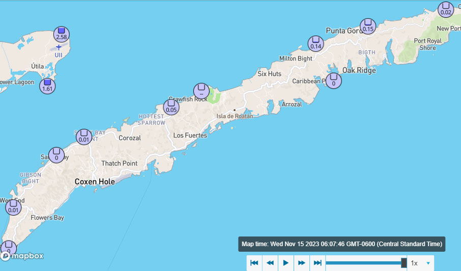
Good morning Bay Islands and hello Utila! you guys have gotten quite wet this morning with 1.5-2.5 inches since 3:30 a.m.
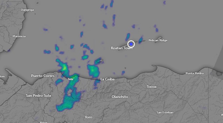
You can see a heavy shower on satellite right over the islands at 6:15 a.m. This activity is drifting south-southwest. There are scattered showers around the other islands too.
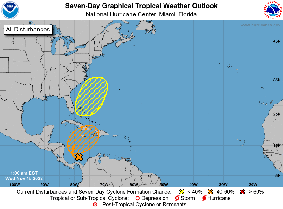
Chance of a tropical depression is down to 50 percent. The fact that it is further east means we will get less rain today than originally forecast. I think today will be a lot like yesterday. Mostly cloudy with a few peeks of sun and scattered showers. Someone asked for an explanation of what the orange box really means and what it tells us about the future of the tropical system I will do that during my video today.
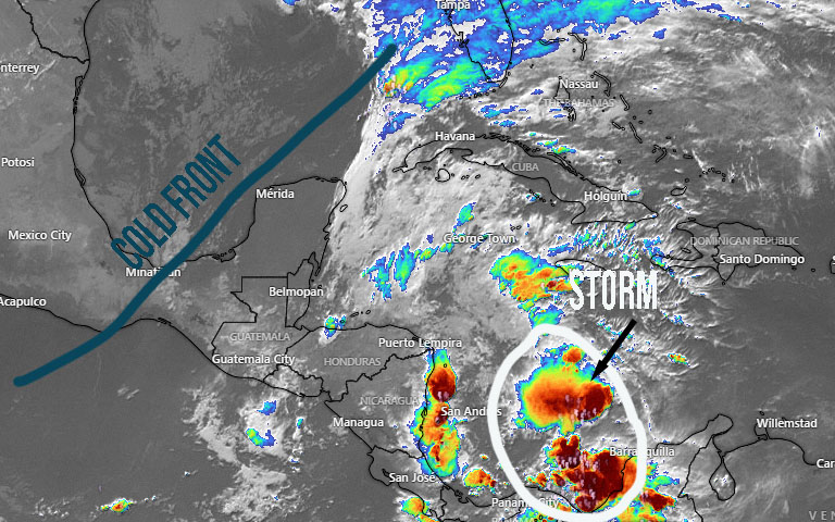
The potential tropical storm is still centered off the coast of Colombia and will stay far enough away that it won’t have a direct impact on our weather. What will have an impact is the cold front north of Yucatan. It will likely bring a wave of rain tomorrow night. Behind it we will have improving weather with maybe a few light showers Friday and Saturday and a really nice Sunday and Monday.
Today and tomorrow we will still be dealing with scattered showers, light winds except in squalls and seas around 3 feet. When our cold front arrives, seas will be up to around 4 feet. Have a great Wednesday!
