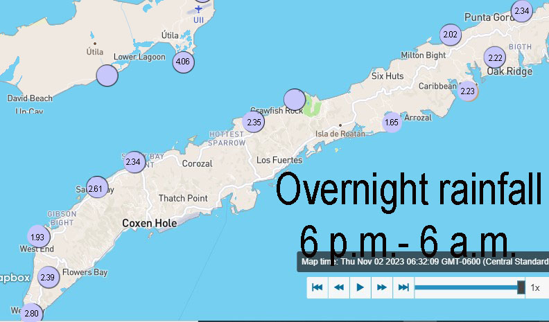
Good morning Bay Islands. Here are our rainfall totals overnight. Very consistent numbers across the big island. We’ve been a bit fortunate in this storm. Puerto Cortes has picked up over 16 inches yesterday and this morning. A bit more for Utila.
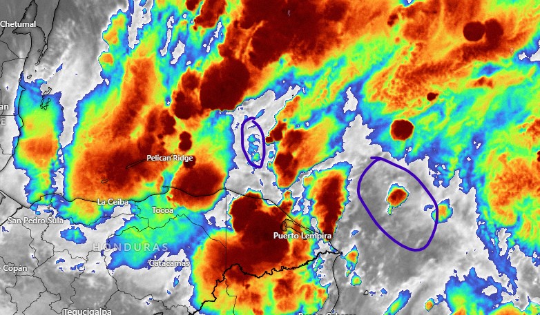
On our satellite we can see that we are in the middle of a lot of storms, though I put purple circles over areas that could give us some breaks later on today. All this activity is moving from east to west.
Winds this morning are from the north around 15 mph and seas on the north side are generally around 5 feet, though at Michael Rock Guanaja they are showing at 6 feet.
Today we will continue to have periods of rain, sometimes heavy and perhaps a peek or two of sunshine. Tonight more rain.
For the weekend we will still have scattered showers, though probably rainfall totals will be a little less than today. Monday we will have isolated showers and Tuesday through the end of the week is looking quite nice, with low winds and seas mostly 2 feet. Another good chance of rain is in the forecast for late next weekend. I’ll do a video later in the morning. Don’t forget to like and subscribe at youtube.com/@roatanweather and support us at patreon.com/roatanweather. Have a great Friday and stay safe!
