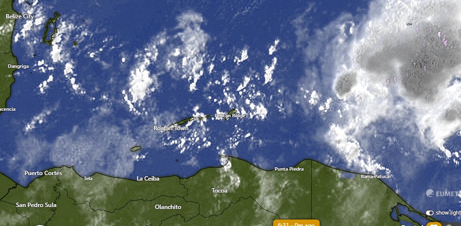
Good morning Bay Islands. This morning we wake up to scattered clouds and there was a shower in Sandy Bay at 6:30 a.m. On satellite you can see some showers about 20 miles north of Utila, and a large area of rain well to our west. Our winds are quite calm and seas are 1-2 feet, so these rain showers are just drifting. We will have a 30 percent chance of a shower today, mostly in the morning and late in the evening.

There is a storm centered off of the coast of Nicaragua this morning that the National Hurricane Center gives a 50 percent chance of turning into a tropical depression before moving inland tomorrow. It will have an indirect effect on our weather.
Today and tomorrow winds and seas will be quite calm, but tomorrow our rain chances go up tomorrow to 40 percent, especially in the evening.
Tuesday and especially Wednesday we will have good chances, around 70 percent, of rain throughout the day.
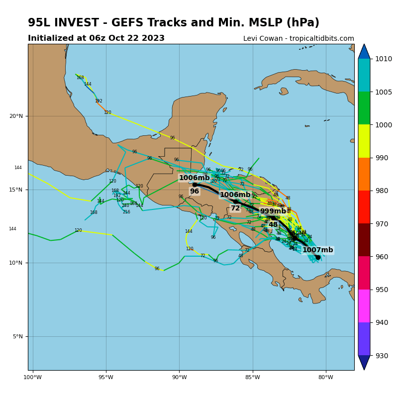
The map with all the lines is called a spaghetti model. It is where different computer forecasts say the storm is going to move. As you can see, the forecasts are all over the place, but most of them say it will drift to the northwest. That is why our forecast is for more rain midweek. If it ends up moving due west out into the Pacific, our rainfall forecast will decrease. Right now we’re also looking for winds from the east to 12-20 mph and seas at 3 feet Tuesday and Wednesday. There is quite a bit of uncertainty with our forecast for the week ahead. We will know more tomorrow morning after we see which way the storm off of Nicaragua has moved. Have a great Sunday.
