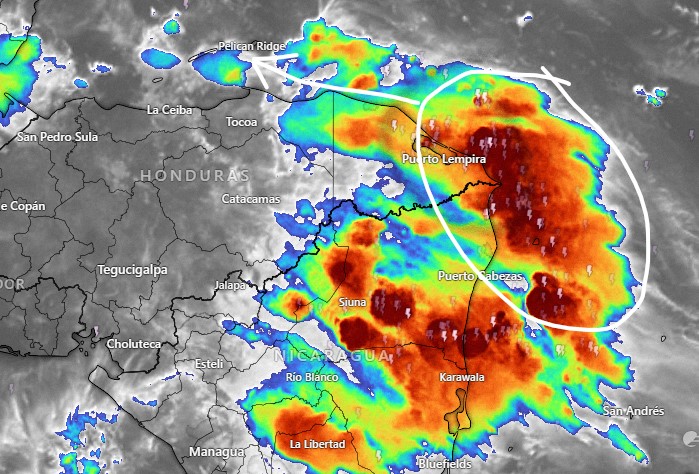
Good morning Bay Islands and welcome to September. The tropical wave we’ve been talking about for the last week will make it here today, mostly this afternoon.
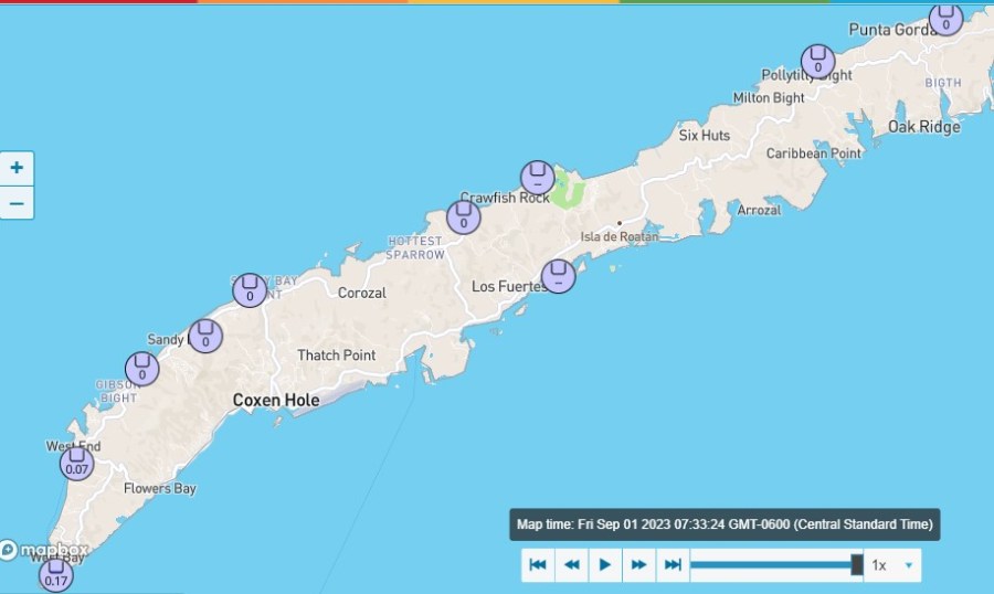
Some pieces of energy from the Mosquito Coast actually made it here this morning and gave some showers to West Bay and West End. These rain totals are as of 7:42 a.m. We start the day windier and wavier than we’ve been for quite awhile, with east winds 15 mph and seas at 3 mph. Those winds and seas will last through the day tomorrow and will get gustier in squalls. While we expect rain this afternoon, it will be weaker and more scattered than what we see on the Mosquito Coast. So expect a 60 percent chance of showers and thundershowers this afternoon, some of them heavy. The 60 percent chance of rain continues overnight into early Saturday morning, but goes down to 30 percent during the middle of the day and afternoon Saturday. Saturday night look for a 40 percent chance of rain. Sunday and Monday should be calmer, but winds go back up to 15-20 mph Tuesday and into next week.
BTW, our super moon low tides haven’t been that bad, but our high tides have been pretty high. High tide today is 9:45 a.m. and 9:30 p.m.
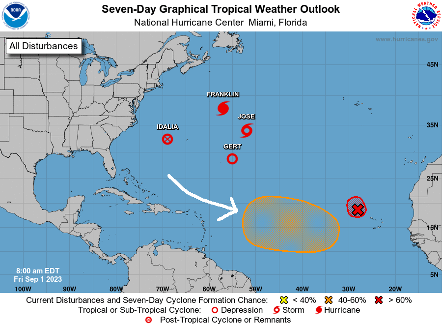
The Atlantic is pretty crowded today, with four named storms, but there is only one area of interest to us. It is the area in orange, with a 50 percent chance of tropical development in the next week. Most models show it forming a tropical storm or hurricane, but turning to the north before entering the Caribbean. It is far enough south for us to keep an eye on, though. Have a great Friday!
