Good morning Bay Islands. Last night some of us got a thunderstorm around 8 p.m. We even got a wind gust of 49 mph on Jonesville Point. But we only got .15 of an inch in the downpour. Many other locations reported a similar amount, though Palmetto Bay reported over half an inch and West Bay and West End reported none.
This morning we have storm clouds to our east which will give us a chance of rain through the morning hours, but the rain is generally moving to the northwest and most of it should miss us. Usually there isn’t a big difference in rain chances among the islands, but this morning I’d give Guanaja a 50/50 shot at rain this morning, 30 percent for Roatan and 20 percent for Utila.
Otherwise, today will be partly to mostly cloudy with east winds 10-15 mph and seas 2 feet. This week we will continue to see decent chances of rain during the night and early morning hours.
Wednesday through Friday look a little windier with east winds 15-20 mph and seas 3 feet during the day and 20-25 mph and seas 4 feet at night. This weekend winds should be calmer and late in the weekend or early next week rain chances go up. Low tide is 2:15 p.m.
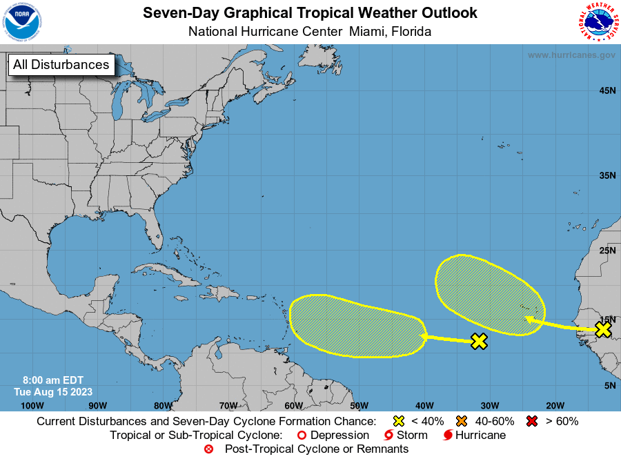
There are two disturbances on the latest National Hurricane Center outlook. The one on the left has a very low (10 percent) chance of development through the next seven days, but its motion is generally toward the Caribbean. While none of the major computer models are making much of this, they do put a lot of moisture into the Caribbean next week and, this time of year with these water temperatures, anything can happen. We’ll keep an eye on it. Have a great Tuesday!
