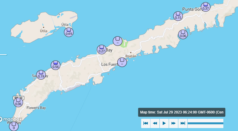
Good morning Bay Islands. Here are the rainfall numbers since midnight. Except for Utila, which shows the half inch they received yesterday afternoon.

This morning most of the storm has moved into the Pacific, though there is still a piece of the storm over us.
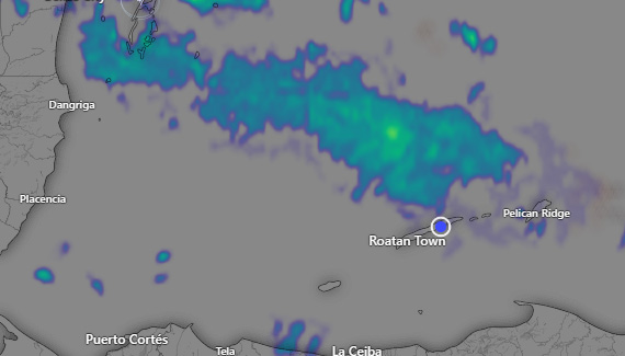
Most of the rain is to our north, but we still have scattered showers to our east, so we will keep a chance of rain through the morning hours.
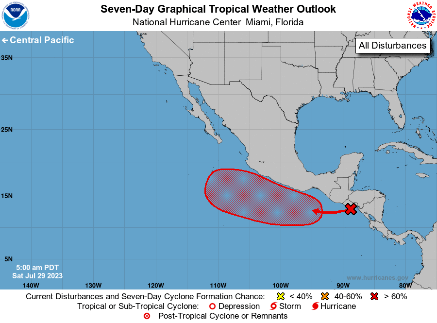
Now that it is moving away from us, this storm has an 80 percent chance of becoming a tropical depression in the Pacific.
Winds this morning are around 20 mph and seas 3-4 feet (1-1.3 meters). Winds should remain around 15-20 mph and seas around 3 feet (1 meter) this weekend and early next week.
After these clouds clear out, the chance of rain looks pretty low this afternoon through tomorrow. Monday through Wednesday the chance of rain looks higher, with scattered storms, mostly at night and in the morning but also possible anytime of day. These won’t be long, all-day rains, but passing downpours like we are used to in July and August on the islands. Low tide is around noon. Have a great weekend!
