July 25, 2023: Good morning Bay Islands. A very narrow band of rain has brought rain between a tenth and a quarter of an inch and at 6:40 a.m. seems to be headed west. There’s a little more to our east so we’ll keep a chance of showers through midmorning.
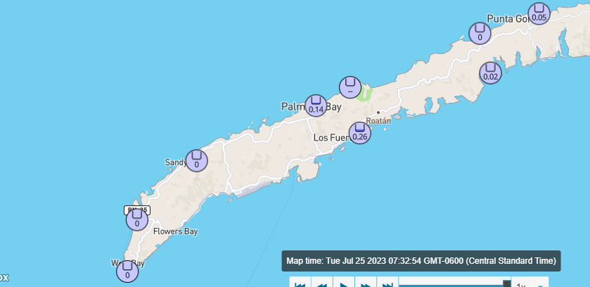
Here are rain totals at 7:40 a.m.
As we wake up east winds are 10-15 mph and seas are 2-3 feet (.6-1 meter). Those winds will continue today, but tomorrow through Friday we will see quite calm conditions with winds 5-10 mph and seas 1-2 feet (.3-.6 meters). We will continue to have partly cloudy days and small chances of overnight and early morning showers through the week. The tropical disturbance about to enter the Caribbean should give us better rain chances this weekend.
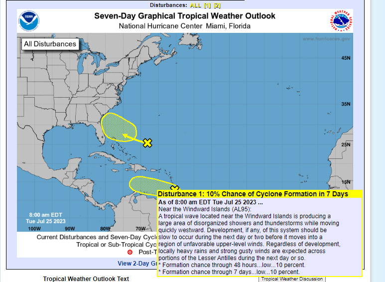
The National Hurricane Center has our tropical disturbance over the Windward Islands down to a 10 percent chance of tropical formation. I expect they will stop putting out forecasts for it today. But that doesn’t mean the rain will go away. We are still looking for an increased chance of rain, perhaps starting Friday night through the weekend.
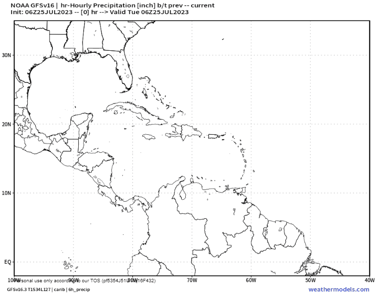
Both the GFS and Euro models are giving us a good chance at this rain. This is the GFS through Saturday night, where you can see the rain forecast to come our way. The Canadian model is sending the moisture further south into Nicaragua. If that happens we will stay mostly dry. But I’d say right now there’s better than a 50/50 chance this weekend we will have occasional showers and a few thunderstorms. Low tide is 8:30 a.m. Have a great Tuesday!
