Good morning Bay Islands. We have quite a bit of rain to our north and a little to our east. We’ll have a chance of a shower through midmorning, but these showers should decrease as the morning goes on. Starting this afternoon and lasting through the early part of next week should be mostly dry.
We start the morning with 20 mph east winds and seas at 4 feet. 20-30 mph east winds and seas 4-5 feet should continue through Monday.
We are still watching the tropics to see what becomes of the disturbance in the Atlantic.
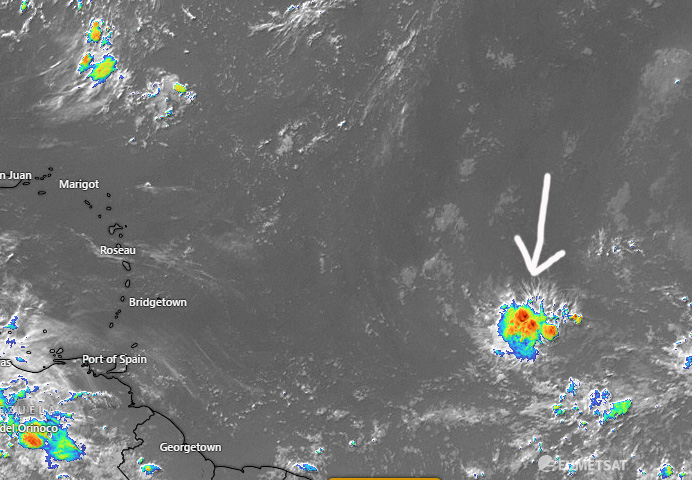
As you can see in the satellite image, the area of showers in the middle of the Atlantic is still a very small storm in a very dry area of the ocean. It is such a small storm the computer models are having a hard time making much of it.
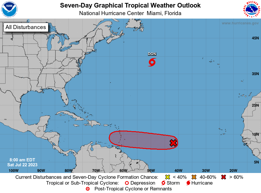
The National Hurricane Center continues to give it a 70 percent chance of becoming a tropical depression. Most of the most reliable models predict this will develop a little in the next few days but then weaken significantly as it enters the Caribbean. The GFS still gives us an increased rain chance next weekend as the moisture comes our way, but some of the models even have the moisture going to our south to Costa Rica. There’s still a great deal of uncertainty here and we will continue to watch it. Low tide is 6 p.m. but we are in a period where low tides aren’t very low. Have a great weekend!
