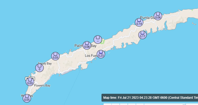
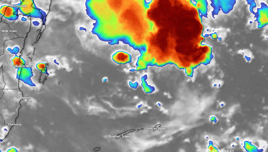
Good morning Bay Islands. Here are the rainfall totals since midnight. Most of this rain fell right after midnight. Also, the far east side got a very good rain yesterday morning.

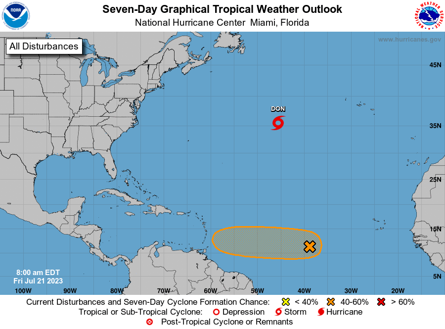
This morning the National Hurricane Center upgraded the chance for tropical development of the wave we’ve been watching in the central Atlantic, up to 40 percent. It’s development has been slowed by some dry air around it, but conditions should get better for development as it gets closer to the eastern Caribbean.
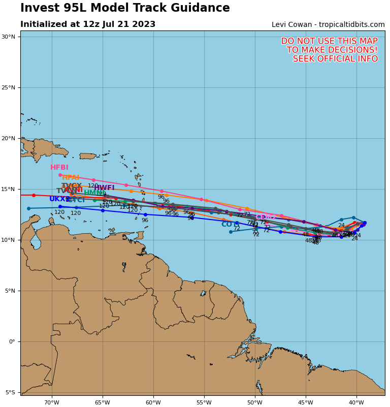
You will notice in the track forecast that all the computers have it coming straight toward us.

This is the American model (GFS) forcast for the Caribbean through Sunday night July 30. You will notice that it doesn’t have the storm developing much in the Caribbean, but it gives us good rain chances for the weekend of July 29-30. This is a best-cast scenario for us because we still need more rain. But there also is reason for concern because the water temperatures are still at very high levels, which could cause the storm to intensify rapidly and this far out it is hard to say exactly what the wind conditions will be. Most of the models are telling us this storm shouldn’t be strong, but right now I’d keep an eye on it and understand that the weekend of July 29-30 is our best chance for being affected by whatever this storm becomes.
