Good morning Bay Islands! Our tropical wave is on our doorstep, the question is will it be able to come in. You can see the mass of moisture centered off the Mosquito Coast that we’ve been waiting for for weeks. It is already bringing good rainfall to the Mosquito Coast and there are even a couple of showers near us on radar at 6 a.m., one east of Guanaja, one north of eastern Roatan. But for the most part, the computers say that the same mainland mountains that weaken most hurricanes before they reach us will also dry out these rain storms before they reach us.

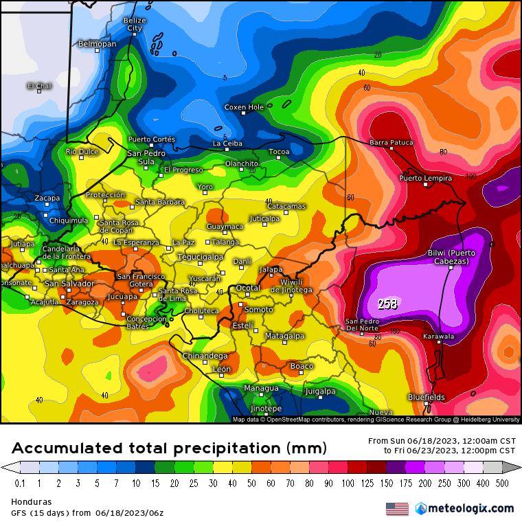
Here’s the GFS rainfall forecast through noon Friday.

And here’s the Euro rainfall forecast through noon Friday.
You will see they leave us in a big blue hole of not much rain. Guanaja is close to a boundary that gets more rain, and I think over the next week many if not all of us will see at least a little rain. I also think that rain will be generally heavier the further west you go, so Guanaja has a much better chance than Utila. Those chances start tonight into tomorrow morning and get a little better into the middle of the week, but each day they are no more than 1 in 3.
Tonight and tomorrow night winds stay fairly strong in the 20-27 mph range. Tuesday the calm a bit to 15-22 mph and Wednesday and Thursday look a lot calmer. Low tide is 3:08 p.m. Have a great Sunday!